
Old Mumbai chawl buildings beside new high-rise towers
CategoriesLand Investment

SRA Redevelopment Records: Checking Slum Rehabilitation Authority Documentation in Mumbai

Key Takeaways

  • The Slum Rehabilitation Authority (SRA) oversees redevelopment of slum land in Mumbai into formal housing, and units allotted under this scheme carry distinct documentation and resale rules.
  • SRA-allotted flats typically carry a lock-in / transfer restriction period (commonly around 10 years from allotment, subject to specific scheme terms) before free resale is permitted.
  • Buyers of SRA-redeveloped units should verify the eligibility certificate, allotment letter, and any transfer permission/NOC from the SRA before purchase, in addition to standard title checks.
  • Not all units in an SRA-redeveloped building are equal — some are allotted to original slum-dwellers (PAP – Project Affected Persons) with restrictions, while others may be “sale component” units developed for open market sale with fewer restrictions.
  • Buying an SRA unit without confirming its specific category and transfer status can lead to serious complications, including a sale being challenged or blocked.

Reading time: 7 min | Last updated: July 2026 | By Girish Chhalwani, Founder & CEO, THE EDGE Developments

Properties in SRA (Slum Rehabilitation Authority) redeveloped buildings in Mumbai carry a documentation and resale framework distinct from standard flats, and buyers need to understand exactly which category of unit they’re purchasing before proceeding. SRA schemes typically produce two broad categories of units within the same redeveloped building — rehabilitation units allotted to original eligible slum-dwellers, and “sale component” units built for open-market sale to fund the redevelopment — and the rules governing resale differ significantly between them.

What Is the SRA and How Redevelopment Works

The Slum Rehabilitation Authority is a Maharashtra government body that facilitates redevelopment of slum land into formal, multi-storey housing. Under the typical model, a developer redevelops the land, provides free rehabilitation flats to eligible original slum-dwellers (verified as Project Affected Persons, or PAP), and is permitted to construct and sell additional units on the open market (“sale component”) to make the project financially viable.

Key Documents to Check for SRA Properties

Document Purpose
Eligibility/Allotment Certificate Confirms whether the unit is a PAP rehabilitation flat or a sale-component unit
Transfer NOC from SRA Required for resale of rehabilitation units, especially within the lock-in period
Occupancy Certificate Confirms the building has received formal completion/occupancy approval
Society Registration & Share Certificate Confirms formal cooperative housing society status and the seller’s membership

PAP Rehabilitation Units vs Sale Component Units

  • PAP Rehabilitation units are allotted free to eligible original slum-dwellers and typically carry resale restrictions for a lock-in period (commonly cited around 10 years, though exact terms depend on the specific scheme and should be confirmed with SRA directly), along with a requirement to obtain SRA transfer permission even after the lock-in.
  • Sale component units are constructed for open-market sale and generally carry fewer SRA-specific restrictions, functioning closer to a standard flat purchase, though buyers should still confirm the building’s overall compliance status.

“The mistake I see most often with SRA properties is buyers not realizing which category of unit they’re actually looking at. A rehabilitation flat still inside its lock-in period being sold without proper SRA transfer permission is a transaction that can unravel later. Get the eligibility certificate and transfer NOC checked before you’re emotionally invested in the deal.” — Girish Chhalwani, Founder & CEO, THE EDGE Developments

How to Verify SRA Documentation Before Buying

  1. Request the specific unit’s eligibility/allotment certificate from the seller to confirm whether it’s a PAP or sale-component unit.
  2. If it’s a PAP rehabilitation unit, confirm the lock-in period status and whether a valid SRA transfer NOC has been obtained.
  3. Verify the building’s Occupancy Certificate and the cooperative society’s formal registration.
  4. Where uncertain, a direct written query to the SRA office referencing the specific scheme and building can confirm current transfer eligibility.
  5. Engage a lawyer experienced specifically in SRA transactions, since the documentation and risk profile differs meaningfully from standard resale flats.

FAQ

What is the SRA?

The Slum Rehabilitation Authority is a Maharashtra government body overseeing the redevelopment of slum land into formal housing in Mumbai.

What’s the difference between a PAP unit and a sale component unit?

PAP (Project Affected Person) units are allotted free to eligible original slum-dwellers with resale restrictions; sale component units are built for open-market sale with generally fewer SRA-specific restrictions.

Is there a lock-in period on SRA rehabilitation flats?

Yes, rehabilitation units typically carry a resale lock-in period, commonly cited around 10 years, though exact terms depend on the specific scheme and should be confirmed directly with the SRA.

Do I need SRA permission to buy a rehabilitation unit?

Often yes — a transfer NOC from the SRA is typically required for resale of rehabilitation units, particularly within the lock-in period.

Are sale component units easier to buy than rehabilitation units?

Generally yes, as they carry fewer SRA-specific transfer restrictions, functioning closer to a standard flat purchase, though building-level compliance should still be verified.

How do I check if an SRA unit’s transfer is legally valid?

Request the eligibility certificate and transfer NOC from the seller, and where uncertain, verify directly with the SRA office referencing the specific scheme and building.

Should I use a specialized lawyer for SRA property purchases?

Yes, SRA transactions carry a distinct documentation and risk profile compared to standard resale flats, making specialized legal review advisable.

Citations & Sources

  • Slum Rehabilitation Authority, Government of Maharashtra

Related Reading

Considering an SRA Property? Know Exactly What You’re Buying

THE EDGE Developments verifies SRA eligibility status, transfer permissions, and building compliance before you commit to a purchase.

connect@theedgedevelopments.com | Phone: +91-9664662938

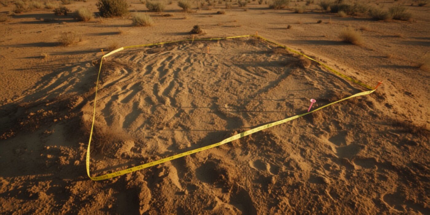
Open plot with survey pegs and measuring tape
CategoriesLand Investment

CTS Number Explained: How City Survey Numbers Identify Urban Land in Maharashtra

Key Takeaways

  • CTS (City Survey/Cadastral Town Survey) Number is the unique identifier assigned to a specific plot of urban land under Maharashtra’s City Survey system — functionally the urban equivalent of a rural survey/gat number.
  • Every Property Card, urban land record, and municipal correspondence about a specific urban plot references its CTS number as the primary identifier.
  • CTS numbers are assigned within a specific city’s or division’s survey system — a duplicate-looking number in a different city or division refers to an entirely different plot.
  • The CTS number is essential for looking up a Property Card, checking building permissions, verifying redevelopment eligibility, or confirming a property’s precise legal identity.
  • CTS numbers can sometimes be sub-divided (e.g., CTS No. 145/A, 145/B) when a larger plot is split — buyers should confirm which specific sub-division applies to the property being purchased.

Reading time: 6 min | Last updated: July 2026 | By Girish Chhalwani, Founder & CEO, THE EDGE Developments

The CTS (City Survey/Cadastral Town Survey) Number is the unique identifier assigned to every urban land parcel in Maharashtra’s City Survey system, functioning as the urban counterpart to the survey or gat number used for rural land. Whether you’re checking a Property Card, verifying redevelopment eligibility, or simply confirming a plot’s exact legal identity, the CTS number is the reference point everything else is built around — and getting it wrong (or confusing it with a similar-looking number from a different division) is a common and avoidable due-diligence mistake.

What Is a CTS Number?

Under Maharashtra’s City Survey system, urban areas — Mumbai, Pune, Nagpur, Thane, Nashik, and other City Surveyed municipal areas — have their land parcels mapped and numbered individually, distinct from the rural survey/gat number system used for agricultural and non-City-Surveyed land. Each parcel receives a CTS number, which becomes its permanent legal reference for Property Card lookups, municipal correspondence, and property transactions.

CTS Number vs Survey/Gat Number

Identifier Where Used Associated Record
CTS Number Urban, City Surveyed areas Property Card
Survey/Gat Number Rural and semi-urban areas 7/12 Extract

As Maharashtra’s 2026 land record reform (see our guide on the 7/12-to-Property Card transition) extends the CTS-based Property Card system into more areas, understanding CTS numbers is becoming relevant for a growing share of buyers beyond the traditionally urban core.

Why the CTS Number Matters for Buyers

  • Unique identity, but not globally unique. CTS numbers are unique within their specific division/ward, but the same number can exist in a different division or city referring to a completely different plot — always confirm the division alongside the CTS number.
  • Basis for Property Card lookup. Any search for an urban property’s ownership, area, or encumbrance status starts with the correct CTS number and division.
  • Redevelopment and building permission reference. Municipal building permission applications, redevelopment consents, and society records all reference the CTS number as the property’s core legal identity.
  • Sub-division tracking. When a larger plot is split (for sale, inheritance, or partial development), sub-divisions are typically denoted with a suffix (e.g., 145/A, 145/B) — buyers should confirm exactly which sub-division corresponds to the unit being purchased.

“I’ve seen buyers get confused because they searched a CTS number without specifying the division, and pulled up the wrong property’s records entirely — numbers repeat across divisions. Always confirm CTS number together with division and ward before you treat any lookup as gospel.” — Girish Chhalwani, Founder & CEO, THE EDGE Developments

How to Find a Property’s CTS Number

  1. Check the property’s existing Property Card, sale deed, or municipal tax receipt — the CTS number is typically printed on all of these.
  2. If unavailable, visit the relevant City Survey office or use the Mahabhumi Property Card portal, searching by address, owner name, or approximate location to identify the CTS number.
  3. Always note the associated division/ward alongside the CTS number itself, since the number alone is not sufficient to uniquely identify the property citywide.

FAQ

What does CTS number mean?

CTS stands for City Survey/Cadastral Town Survey — it’s the unique identifier assigned to urban land parcels under Maharashtra’s City Survey system.

Is CTS number the same as survey number?

No — survey/gat numbers apply to rural and semi-urban land tied to 7/12 extracts, while CTS numbers apply to urban, City Surveyed land tied to Property Cards.

Can the same CTS number exist in two different places?

Yes — CTS numbers are unique within their specific division/ward, so the same number in a different division refers to an entirely different property. Always confirm the division too.

Where do I find my property’s CTS number?

It’s typically printed on the Property Card, sale deed, or municipal tax receipt; if unavailable, the City Survey office or Mahabhumi portal can help locate it.

What does a CTS number with a suffix like “145/A” mean?

It indicates a sub-division of the original plot, typically created when a larger parcel was split for sale, inheritance, or partial development.

Do I need the CTS number for redevelopment projects?

Yes — redevelopment consents, building permissions, and society records all reference the CTS number as the property’s core legal identifier.

Citations & Sources

  • Mahabhumi Property Records Portal — mahabhumi.gov.in
  • Maharashtra Land Revenue Code, 1966

Related Reading

Verifying an Urban Plot’s Legal Identity? Start With the Right CTS Number

THE EDGE Developments confirms CTS numbers, divisions, and Property Card details accurately on every urban property we recommend.

connect@theedgedevelopments.com | Phone: +91-9664662938

Aerial view of Mumbai suburban skyline contrasted with historic architecture
CategoriesLand Investment

Mumbai City vs Mumbai Suburban: Two Districts, Two Different Land Record Systems

Key Takeaways

  • Mumbai City (the island city — Colaba to Mahim/Sion) and Mumbai Suburban (Bandra to Dahisar/Mulund) are two separate administrative districts, each with their own Collector and revenue machinery.
  • Both districts use the Property Card system rather than the 7/12/8A framework used in the rest of Maharashtra, since Mumbai’s land records were urbanized and City Surveyed much earlier than most of the state.
  • Despite using the same Property Card format, some administrative processes, ward jurisdictions, and specific record-keeping details differ between the two districts.
  • Buyers should confirm which district a property falls under, since that determines which Collector’s office, City Survey office, and specific ward-level record system applies.
  • Mumbai Suburban, being more recently developed than the island city in many pockets, has a mix of long-settled Property Card records and some newer developments still working through initial documentation.

Reading time: 6 min | Last updated: July 2026 | By Girish Chhalwani, Founder & CEO, THE EDGE Developments

Mumbai City and Mumbai Suburban are two distinct administrative districts within Greater Mumbai, each with its own Collector, and while both use the Property Card system for land records, the practical administration of these records differs between them. For a buyer, this matters mainly at the level of knowing which office to approach, and understanding that “Mumbai” isn’t administratively a single homogenous unit when it comes to land record verification.

Mumbai City vs Mumbai Suburban: The Basic Split

District Approximate Coverage
Mumbai City The original “island city” — Colaba, Fort, Marine Lines, Byculla, Parel, Dadar, Mahim, Sion
Mumbai Suburban Bandra through Dahisar on the western side, and Kurla through Mulund on the eastern/central side

Both districts fall under Greater Mumbai and are governed civically by the same BMC/MCGM for municipal services and property tax, but they are separate revenue districts for land record purposes, each with a distinct Collector’s office.

Why Both Use the Property Card System

Unlike most of rural and semi-urban Maharashtra, which uses the 7/12 extract and 8A framework under the standard revenue survey system, Mumbai’s land was subjected to a formal City Survey much earlier due to its dense, urbanized development history. As a result, both Mumbai City and Mumbai Suburban districts use Property Cards (CTS-number-based records) instead of the 7/12/Gat-number system — the same core reform now being extended statewide (see our guide on the 2026 7/12-to-Property Card transition).

Where the Two Districts Differ in Practice

  • Separate Collector offices. Mumbai City and Mumbai Suburban each have their own District Collector responsible for revenue administration, which affects where certain applications (like Property Card corrections) need to be filed.
  • Ward-level record variation. Since Mumbai Suburban includes areas that urbanized more recently than the island city, some pockets have a mix of older, well-settled Property Card records and newer developments where documentation is still catching up.
  • CTS number ranges. CTS (City Survey/Cadastral Town Survey) numbers are assigned within each district’s own numbering system, so the same CTS number format doesn’t uniquely identify a property without also specifying the district and division.

“Buyers moving between Mumbai City and Mumbai Suburban properties sometimes assume the record system and process will be identical everywhere in Mumbai. The Property Card format is the same, but which Collector’s office you deal with, and how quickly a correction or query gets resolved, can differ. Confirm the district and division specifically for the property you’re evaluating.” — Girish Chhalwani, Founder & CEO, THE EDGE Developments

How to Check Which District a Property Falls Under

The Property Card itself will specify the district (Mumbai City or Mumbai Suburban), division, and CTS number. If uncertain from available documents, the area/locality name is usually a reliable indicator — anything from Bandra northward is Mumbai Suburban; anything from Mahim/Sion southward is Mumbai City — though boundary-adjacent properties should be confirmed directly.

FAQ

What’s the difference between Mumbai City and Mumbai Suburban districts?

They are two separate administrative revenue districts within Greater Mumbai — Mumbai City covers the original island city area, while Mumbai Suburban covers the areas from Bandra/Kurla northward.

Do both districts use the same land record system?

Yes, both use the Property Card (CTS-based) system rather than the 7/12 extract used in the rest of Maharashtra, since Mumbai underwent an earlier City Survey.

Why does it matter which district my property is in?

Each district has its own Collector’s office responsible for revenue administration, which affects where Property Card corrections or queries need to be filed.

How do I know if my property is in Mumbai City or Mumbai Suburban?

The Property Card specifies the district directly; as a general guide, areas from Mahim/Sion southward fall under Mumbai City, and Bandra northward falls under Mumbai Suburban.

Is the CTS number system the same across both districts?

CTS numbers are assigned within each district’s own numbering system, so the same number format requires the district and division to uniquely identify a property.

Are property tax rates different between Mumbai City and Mumbai Suburban?

Both fall under the same BMC/MCGM for municipal property tax purposes, though actual tax amounts vary by locality-specific factors like Ready Reckoner rate and usage category, not by district designation alone.

Citations & Sources

  • Mahabhumi Property Records Portal — mahabhumi.gov.in
  • Maharashtra Land Revenue Code, 1966

Related Reading

Buying Across Mumbai’s Two Districts? We Know the Difference

THE EDGE Developments navigates Mumbai City and Mumbai Suburban land records, Collector processes, and title verification for every buyer we work with.

connect@theedgedevelopments.com | Phone: +91-9664662938

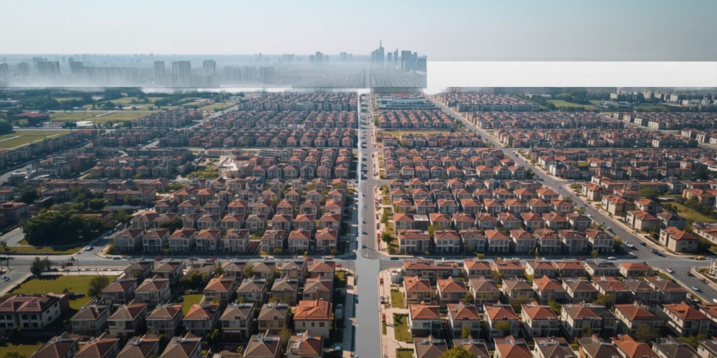
Aerial view of urban residential blocks and street grid representing property card records
CategoriesLand Investment

Property Card (Malmatta Patrak) Explained: Urban Land Records in Maharashtra

Key Takeaways

  • A Property Card (Malmatta Patrak) is Maharashtra’s urban land ownership record, maintained by the City Survey Office — the direct counterpart to the rural 7/12 extract.
  • It identifies land by CTS Number (City Survey/City Town Survey Number), not the Survey/Gat Number used in rural 7/12 records.
  • A Property Card shows ownership, plot/built-up area, tenure type, and a mutation history of past transactions and encumbrances on the property.
  • You can view/download a Property Card online via mahabhumi.gov.in for Mumbai Suburban and most other districts, and via mumbaicity.gov.in specifically for Mumbai City district.
  • For buyers, the Property Card is the single most important document to confirm you’re dealing with the legal urban owner before any agreement or payment.
  • Unlike a 7/12, a Property Card carries no agricultural/crop data — because urban land, by definition, isn’t classified for cultivation.

Reading time: 7 min | Last updated: July 2026 | By Girish Chhalwani, Founder & CEO, THE EDGE Developments

A Property Card, called Malmatta Patrak in Marathi, is the official ownership record for land and buildings within Maharashtra’s urban municipal limits — the city equivalent of the rural 7/12 extract. Where a 7/12 tracks agricultural land by Survey Number and Talathi jurisdiction, a Property Card tracks urban land by CTS Number under the City Survey Office. If you’re buying a plot, flat, or commercial unit inside any municipal council or corporation area in Maharashtra, the Property Card — not the 7/12 — is the record that legally matters.

What a Property Card Contains

A Property Card is a structured document with several distinct fields, all of which a buyer or lender should review line by line:

Field What It Tells You
CTS Number (City Survey/City Town Survey No.) The unique identifier for the plot under the City Survey system — equivalent to a Survey/Gat number in rural areas.
Owner’s Name(s) Current legal owner(s) as per government records; check this matches your seller exactly.
Area Plot area in square metres, as measured during City Survey.
Tenure Type Freehold, leasehold, or occupancy class (Class I / Class II) — leasehold and Class II land carry transfer restrictions.
Encumbrances Mortgages, charges, court attachments, or other claims registered against the property.
Mutation Entries A running log of ownership changes — sales, inheritance, gift, partition — each referencing the transaction that caused it.
Ward/Zone/Village Reference Administrative location within the municipal corporation or council.

What’s Missing Compared to a 7/12

A Property Card does not carry the crop/cultivation column (Column 12) or “Other Rights” agricultural tenancy entries that appear on a 7/12. That’s intentional — a Property Card exists for land that is administratively urban, where agricultural cultivation status is not the relevant legal question. Instead, the Property Card focuses on ownership clarity and encumbrance disclosure, which matters more for construction, sale, and mortgage purposes.

Property Card vs 7/12: Side-by-Side

Feature 7/12 Extract Property Card
Applies to Rural / agricultural land Urban land within municipal limits
Maintained by Talathi (village revenue officer) City Survey Office
Identifying number Survey No. / Gat No. / Hissa No. CTS Number
Crop/cultivation data Yes (Column 12) No
Mutation process e-Ferfar via Talathi City Survey Office mutation entry
Primary online portal mahabhulekh.maharashtra.gov.in mahabhumi.gov.in / mumbaicity.gov.in

If you want the fuller mechanics of reading a 7/12 line by line, we’ve covered that separately in our complete 7/12 extract guide.

How to Obtain or View a Property Card Online

For Mumbai Suburban District and Most Other Districts

  1. Visit mahabhumi.gov.in, the Maharashtra Department of Land Records’ portal.
  2. Navigate to the Property Card / Malmatta Patrak lookup section for your district.
  3. Select district, taluka, and either village/ward or directly enter the CTS number.
  4. Search — the record displays owner name, area, and CTS details. A digitally signed copy can typically be downloaded for a nominal fee.

For Mumbai City District

  1. Visit mumbaicity.gov.in, the official Mumbai City district administration portal.
  2. Locate the Property Card / land records section (Mumbai City has a separate Collector’s office and record system from Mumbai Suburban).
  3. Search by CTS number, ward, or division.
  4. Download or request a certified copy through the City Survey Office if the online copy isn’t sufficient for your transaction (banks and registrars often want a certified copy for high-value deals).

In Person

You can also apply directly at the local City Survey Office / Superintendent of Land Records office with your CTS number, old survey number (if converting), or address details. This is often necessary if the online record shows a discrepancy or the property was only recently surveyed.

Why the Property Card Matters for Buyers

  • Confirms legal ownership. The name on the Property Card must match your seller’s identity documents exactly — mismatches (a deceased owner still listed, a name from an incomplete inheritance mutation) are red flags.
  • Reveals encumbrances upfront. Existing mortgages or charges show here before you commit funds — always cross-check against an Encumbrance Certificate from IGR Maharashtra as a second layer.
  • Confirms tenure type. Leasehold land (common in old Mumbai chawls, MHADA layouts, and some redevelopment plots) carries transfer restrictions a freehold buyer wouldn’t face.
  • Required for loans. Banks will not sanction a mortgage on urban property without a current Property Card matching the applicant’s name.
  • Essential during 7/12-to-Property Card transitions. As Maharashtra converts more peri-urban villages into municipal limits, buyers in growth corridors need to confirm whether a plot’s authoritative record is now the Property Card, not the old 7/12.

“Buyers still walk into deals assuming a 7/12 extract is proof enough, even when the land is sitting inside a municipal limit. If the plot is urban, the Property Card is the record that governs the transaction — not the old rural extract. Always match the CTS number, not just the name, before you sign.” — Girish Chhalwani, Founder & CEO, THE EDGE Developments

Common Issues to Watch For

Issue Why It Matters
Owner name mismatch after inheritance Mutation may not be updated; legal heirs may not all be reflected as co-owners.
Old CTS number vs re-surveyed CTS number Some areas have been re-surveyed, changing CTS numbers; confirm you’re viewing the current number.
Leasehold expiry approaching Leasehold Property Cards should state lease tenure; check remaining years before buying.
Pending mutation entries A sale in progress but not yet mutated can create temporary ownership ambiguity.

Frequently Asked Questions

What is a Property Card in Maharashtra?

A Property Card (Malmatta Patrak) is the official urban land ownership record maintained by the City Survey Office, showing CTS number, owner details, area, tenure, and encumbrances for land within municipal limits.

How is a Property Card different from a 7/12 extract?

A 7/12 extract covers rural/agricultural land and is maintained by the Talathi; it includes crop and cultivation data. A Property Card covers urban land, is maintained by the City Survey Office, and has no agricultural columns.

Where can I check my Property Card online?

For Mumbai Suburban and most other Maharashtra districts, use mahabhumi.gov.in. For Mumbai City district specifically, use mumbaicity.gov.in.

What is a CTS number?

CTS stands for City Survey/City Town Survey Number — the unique plot identifier used in the Property Card system, equivalent to the Survey/Gat number used in rural 7/12 records.

Does a Property Card show if the land is mortgaged?

Yes, encumbrances such as mortgages and charges are recorded on the Property Card, but buyers should always cross-verify with an Encumbrance Certificate from IGR Maharashtra as an independent check.

Is a Property Card enough proof of ownership on its own?

It is strong evidence but should be paired with title deed verification, an Encumbrance Certificate, and (for larger transactions) a lawyer’s title search — no single document is fully conclusive on its own.

Can I get a Property Card for agricultural land?

No. Property Cards apply only to land within municipal council or corporation limits. Agricultural land outside these limits continues to use the 7/12 system.

What happens if my village recently got merged into a municipal corporation?

Once City Survey is completed for your area, your land’s record will migrate from 7/12 to Property Card, and you’ll be assigned a CTS number in place of your old survey number.

Who do I contact if my Property Card details are wrong?

Approach the local City Survey Office / Superintendent of Land Records with supporting documents (sale deed, inheritance papers, prior mutation records) to request a correction.

Citations & Sources

Related Reading

Buying Urban or Peri-Urban Property in Maharashtra?

THE EDGE Developments verifies Property Card, CTS number, and encumbrance status on every land recommendation before you commit a rupee. Reach out before you sign.

connect@theedgedevelopments.com | Phone: +91-9664662938