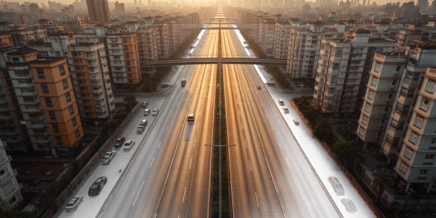
Aerial view of a widened urban road with mid-rise buildings set back along a Maharashtra corridor
CategoriesLand Investment Market Insights Mumbai 3.0 NRI Guides tips & tricks Uncategorized Weekend Homes

Transit-Oriented Development in Maharashtra: FSI Along Metro and Expressways

TL;DR — Key Takeaways

  • TOD is a rule, not a slogan. Maharashtra’s transit-oriented development sits in UDCPR 2020, which permits total FSI up to 4.0 inside a 500 m TOD zone around a metro or suburban-rail station, subject to road width, plot size and premium charges.
  • Expressway frontage does NOT get TOD FSI. The Samruddhi Mahamarg and Mumbai–Pune Expressway are access-controlled; Maharashtra does not upzone their edge, delivering density at planned nodes instead.
  • The Samruddhi’s density lever is up to 19 planned new towns (Krushi Samruddhi Nagar) via MSRDC’s New Town Development Authority — ~30–40 km apart, not a frontage belt.
  • Near Mumbai, density means NAINA / Third Mumbai and the Atal Setu interchanges — growth-centre FSI and interchange-led town planning, not bridge-frontage upzoning. The buyer signal is proximity to a planned station or node, verified against the plan — not a plot that merely touches an expressway.

Transit-oriented development in Maharashtra, answered directly

Direct answer: In Maharashtra, transit-oriented development (TOD) is enacted through the Unified Development Control and Promotion Regulations (UDCPR) 2020, which allow a maximum total Floor Space Index (FSI) of 4.0 — base plus incentive — within a 500-metre TOD zone measured around a metro or suburban-rail station boundary, subject to minimum road width, plot criteria and premium FSI charges. There is currently no Maharashtra regulation that grants the same higher FSI along expressway frontage. Access-controlled corridors such as the Samruddhi Mahamarg and the Mumbai–Pune Expressway instead concentrate density at planned nodes and growth centres. So the “expressway TOD” headline is real as a direction of travel, but in Maharashtra it is delivered through node authorities, not through upzoning the land beside the tarmac.

That distinction is the whole investment thesis: a plot 400 metres from a sanctioned metro station can carry a very different development right from a plot that merely fronts an expressway. Confusing the two is how buyers overpay for “corridor land” that carries no extra FSI.

What UDCPR 2020 actually permits inside a TOD zone

Direct answer: UDCPR 2020’s transit-oriented development provisions define the TOD zone as the area within 500 metres of a proposed metro-rail (or notified suburban-rail) station and allow total FSI up to 4.0, including the base permissible FSI, once the road-width and plot conditions are met.

The key conditions that decide whether a plot can actually reach 4.0 FSI:

  • Location: the plot must fall within the 500 m station zone. Where 50% or more of a plot lies inside the zone, the TOD FSI applies to the whole plot.
  • Road width: the higher FSI is tied to abutting road width; mixed residential-plus-commercial use is permitted on plots fronting a road of 12 m and above.
  • Tenement mix: dwelling units are capped between 25 sq m and 120 sq m carpet area, with a large share of units required to stay at or below 60 sq m — TOD is designed for compact, dense, walkable housing near the station, not villas.
  • Premium payable: the incentive FSI over the base is bought from the planning authority at a premium benchmarked to the Ready Reckoner rate.

The national frame sits above this: the Ministry of Housing and Urban Affairs’ National TOD Policy (2017) recommends a 500–800 m influence zone, but land is a State subject, so it is UDCPR 2020 — not the central policy — that binds in Maharashtra. And regulators have clarified an important nuance: the 4.0 FSI attaches to the station zone, not to the whole length of a corridor.

Corridor by corridor: what is enacted, what is proposed

Below, “enacted” means the rule or infrastructure is in force today; “proposed / under development” means the density mechanism exists on paper or is being built out but is not fully delivered.

Corridor / area TOD / FSI status What it actually enables
Metro & suburban-rail stations (MMR, Pune, Nagpur) Enacted — UDCPR 2020 TOD zone, FSI up to 4.0 within 500 m of a station Compact, mixed-use density around sanctioned stations; the clearest legal upzoning available in Maharashtra
Samruddhi Mahamarg (Nagpur–Mumbai, 701 km) Infra enacted (fully open June 2025); frontage TOD not permitted — access-controlled Density at up to 19 planned new towns (Krushi Samruddhi Nagar) ~30–40 km apart, via MSRDC’s New Town Development Authority — proposed / under development
NAINA / Third Mumbai (Raigad) Planning enacted (notified 10 Jan 2013, CIDCO as authority); TOD guidelines being formulated 60:40 land pooling returning serviced plots with FSI ~1.7–2.5 to owners; higher growth-centre FSI with premium — station clusters proposed
Atal Setu / MTHL influence area Infra enacted (opened 13 Jan 2024, 21.8 km); interchange-led growth, no bridge-frontage FSI Value concentrates at the three interchanges (Sewri, Shivaji Nagar, Chirle) and the designated Karnala-Sai-Chirner “Third Mumbai” new town — node-led
Mumbai–Pune Expressway Infra enacted; access-controlled, no frontage TOD Connectivity gains are captured at the towns and nodes it links (Panvel, Talegaon, Hinjawadi), not along its edge

Why expressways behave differently from metros

Direct answer: An expressway is legally access-controlled — you cannot build a driveway onto it — so it moves people through a region rather than gathering them at walkable stations, which is why Maharashtra assigns density to planned nodes beside expressways rather than to the frontage.

The Samruddhi Mahamarg is the textbook case: a 701 km, six-lane greenfield expressway crossing ten districts, with a 150 km/h design speed and no shopfront access. So the growth model is deliberately node-based — MSRDC set up a New Town Development Authority to build a string of self-contained townships (the Krushi Samruddhi Nagar nodes) where planned FSI and industry concentrate. Land value therefore rises in rings around those nodes and interchange villages, not uniformly along all 701 km. The Mumbai–Pune Expressway behaved the same way: two decades of appreciation went to Panvel, Talegaon and Hinjawadi — the places it connects — not the farmland beside the carriageway.

“Buyers keep asking me for ‘expressway-touching’ plots as if the road itself carries FSI. It does not. In Maharashtra the density right lives at a sanctioned station or a notified node — so the money question is always the same: which plan is this plot inside, and what does that plan permit? Verify the zone before you fall in love with the address.”

— Girish Chhalwani, Founder & CEO, THE EDGE Developments

What this means for land value near Mumbai

For investors along the Mumbai growth corridors, three rules follow from the regulation:

  1. Price the plan, not the postcard. A plot near a sanctioned metro station inside a 500 m TOD zone can support up to 4.0 FSI; a plot beside an expressway usually supports only its base zone FSI. The premium belongs to the first.
  2. Follow the nodes on greenfield corridors. On the Samruddhi and around NAINA, the upside sits at planned new towns and growth centres. Our read of the Third Mumbai and NAINA airport city shows how a notified authority — not proximity alone — resets values.
  3. Buy inside verified plans, not near them. Whether you weigh Neral versus Karjat for 2026 or a Samruddhi node, confirm the zone, the reservation and the title before the price.

None of this replaces diligence. Corridor upside does not fix a defective title, an agricultural-use restriction, or a reservation through your plot. Run the 12 red flags to check before you buy a plot in MMR against any corridor plot — a TOD address with a title problem is still a title problem.

Thinking about a plot along a Maharashtra growth corridor?

THE EDGE Developments verifies the zone, the plan and the title before you buy — so you pay for real FSI, not a nice address. Talk to our Land Intelligence team.

Contact THE EDGE Developments »

Frequently asked questions

Does Maharashtra allow higher FSI along expressways like the Samruddhi Mahamarg

No. Maharashtra does not grant transit-oriented FSI along expressway frontage, because expressways such as the Samruddhi Mahamarg and the Mumbai-Pune Expressway are access-controlled. Higher density is instead delivered at planned nodes – on the Samruddhi, at up to 19 Krushi Samruddhi Nagar new towns built by MSRDC’s New Town Development Authority – not on the land that simply touches the expressway.

What is the maximum FSI in a UDCPR 2020 TOD zone

Under UDCPR 2020, the maximum total FSI in a TOD zone is 4.0, including the base permissible FSI. Reaching it depends on conditions: the plot must lie within the station zone, meet minimum abutting road width, satisfy plot-size criteria, and the incentive FSI over the base is bought at a premium linked to the Ready Reckoner rate.

How large is the TOD zone around a metro station in Maharashtra

The UDCPR 2020 TOD zone is the area within 500 metres of the proposed metro station boundary. Where 50 percent or more of a plot falls inside that 500-metre zone, the TOD regulations, including the higher FSI, apply to the whole plot. The national policy references a wider 500 to 800 metre influence zone, but the binding Maharashtra figure is 500 metres.

Are the new towns along the Samruddhi corridor the same as TOD

Not exactly. The Krushi Samruddhi Nagar new towns are planned self-contained townships developed by a New Town Development Authority, whereas UDCPR 2020 TOD is station-centred upzoning within 500 metres of a metro or rail station. Both concentrate density, but they run under different rules and grant different development rights, so a buyer must check which one governs a given plot.

How does transit-oriented development change land values near Mumbai

Transit-oriented development raises land value where a plot sits inside a sanctioned station zone or a notified node with in-force higher FSI, because more buildable area supports a higher land price. It does little for land that only borders a corridor. Near Mumbai, the strongest signals are NAINA growth centres, the Atal Setu interchanges and metro station zones – verified against the plan, not the map alone.

Disclaimer

This article is general information on Maharashtra’s development-control framework as understood on 13 August 2026, not legal, planning or investment advice. FSI entitlements, TOD-zone boundaries, premium rates and node plans change and are plot-specific, and several mechanisms cited here are proposed or under development rather than fully in force. Always verify the governing DCPR, the sanctioned plan and the title for a specific plot with the planning authority and a qualified professional before transacting. THE EDGE Developments accepts no liability for decisions taken solely on this article.

Related reading

Related land-policy updates from THE EDGE

Citations and sources

Aerial view of a new road alignment cutting through green farmland in Maharashtra
CategoriesMarket Insights

Which Mumbai Infrastructure Actually Moves Land Values in 2026

Key Takeaways

  • Metro-3 (Aqua Line) and the Mumbai Coastal Road move built-up city property, not plotted land. They compress travel time inside Mumbai, so they lift flats, offices and redevelopment plots in South Mumbai, BKC, Worli and the SEEPZ belt — they do not open new land supply.
  • Metro-3 is fully operational — the final Acharya Atre Chowk–Cuffe Parade stretch opened on 8 October 2025, completing the 33.5 km, 27-station Cuffe Parade–Aarey line.
  • The Coastal Road (South) Phase 1 is open; the western/northern extension toward Kandivali is under construction with no confirmed completion date.
  • What actually reprices plotted land near Mumbai is different infrastructure — the Navi Mumbai International Airport, the Virar–Alibaug Multimodal Corridor, the Mumbai–Pune Missing Link, Vadhavan Port and the Panvel–Karjat rail line — projects that open previously disconnected land.
  • Land reprices 3–7 years before a project is commissioned, not after. Reading an infrastructure announcement correctly matters more than the headline.

The honest answer: what moves flats is not what moves land

Metro-3 and the Mumbai Coastal Road are city-transport projects — they raise prices for flats, offices and redevelopment plots inside Mumbai, but they do not move raw plotted land in the periphery near Karjat, Neral or the wider Mumbai Metropolitan Region hinterland. A metro line and a seafront freeway make an already-built city easier to move around. They do not open new land supply, so their effect on land value shows up as urban redevelopment, not greenfield appreciation.

This matters because most investor headlines blur the two. “Metro-3 is open” is a genuine event — it just reprices the wrong asset class for anyone buying plotted, non-agricultural (NA) land. The infrastructure that actually reprices land near Mumbai is a different list: a new airport, expressways, freight and multimodal corridors, and a port — the projects that connect land that was previously too far to reach. This post separates the two clearly, then gives you a framework for reading any future infrastructure announcement the way a land buyer should.

Metro-3 (Aqua Line): fully operational, and what it repriced

Mumbai Metro Line 3 — the Aqua Line — has been fully operational since 8 October 2025. Built by the Mumbai Metro Rail Corporation (MMRC), it runs 33.5 km fully underground with 27 stations, from Cuffe Parade in the south to Aarey/SEEPZ in the north. The line opened in phases: BKC–Aarey began commercial service on 7 October 2024, the BKC–Acharya Atre Chowk stretch on 9 May 2025, and the final Acharya Atre Chowk–Cuffe Parade section on 8 October 2025.

What it reprices is the built-up office-and-premium-residential spine: Cuffe Parade and Nariman Point, Fort and Churchgate, Worli and Lower Parel, BKC, Dadar, Mahalaxmi, and the Marol/SEEPZ commercial belt near the airport. In every one of those micro-markets the value lever is faster access to jobs applied to already-built floor space. There is no vacant plotted-land supply on the Aqua Line alignment to reprice — the land is decades built out. For a land investor, Metro-3 is a case study in city-mobility value, not a plotted-land signal.

Mumbai Coastal Road: Phase 1 open, extension under construction

The Coastal Road (South) — formally the Dharmaveer Swarajya Rakshak Chhatrapati Sambhaji Maharaj Mumbai Coastal Road — has its Phase 1 open, built by the Brihanmumbai Municipal Corporation (BMC). Phase 1 runs 10.58 km from the Princess Street Flyover at Marine Lines to the Worli end of the Bandra–Worli Sea Link; it was inaugurated on 11 March 2024, and the seafront promenade opened in August 2025.

The northern extension — roughly 19.22 km from the Bandra sea-link end toward Kandivali, including the Versova–Bandra Sea Link — is under construction, with no verified firm completion date; a further Versova–Virar sea link has MMRDA approval but no published timeline. What Phase 1 repriced is South Mumbai luxury residential: Marine Drive, Malabar Hill, Breach Candy and Worli, where travel-time compression to South Mumbai is the value driver. As the western arm extends it will lift built-up value in Bandra, Juhu/Versova and the western suburbs. Again: built-up residential, not peripheral plotted land.

City infrastructure vs land-moving infrastructure: the comparison

The cleanest way to see the distinction is side by side. The middle column is what the project actually reprices; the right column answers the only question a plotted-land buyer near Mumbai should ask.

Project What it moves Does it move plotted land near Mumbai?
Metro-3 / Aqua Line (operational) Flats, offices, redevelopment plots on the alignment (South Mumbai, BKC, Worli, SEEPZ) No — intra-city mobility, no new land supply
Mumbai Coastal Road (Phase 1 open) South Mumbai & western-suburb built-up residential No — a city freeway, opens no hinterland
Navi Mumbai International Airport (NMIA) Land across Navi Mumbai, Panvel, Ulwe, Karjat belt Yes — a new economic anchor opening peripheral land
Virar–Alibaug Multimodal Corridor (VAMC) Land across the outer MMR growth ring Yes — connects previously disconnected land
Mumbai–Pune Expressway / Missing Link Land along the Karjat–Khalapur–Khopoli corridor Yes — cuts travel time, opens plotted supply
Vadhavan Port (under development) Land across the North MMR / Palghar belt Yes — a freight-and-jobs anchor for a new region
Panvel–Karjat rail line (under construction) Land around Panvel, Chowk and Karjat stations Yes — a rail terminus opening the Karjat side

Framework attribution: the “what reprices land” distinction is THE EDGE Developments’ own analysis, drawn from our published Karjat corridor case study — not a government finding.

The infrastructure that actually reprices land near Mumbai

Land reprices when a project connects land that was previously too far to reach, or plants a new economic anchor where there was none. Five projects in the current MMR pipeline do exactly that — and none of them is a city metro or a seafront road.

Navi Mumbai International Airport (NMIA) is the single largest land-repricing anchor in the region. A new airport creates jobs, warehousing, hospitality and second-home demand across a wide radius — Panvel, Ulwe, and the Karjat–Khopoli belt — where plotted NA land still exists to be repriced.

The Virar–Alibaug Multimodal Corridor stitches together the outer MMR growth ring, connecting land parcels that never had a direct high-speed link. Corridors like this reprice land precisely because they change what is reachable, not merely how fast you move within a place already built.

The Mumbai–Pune Expressway and its Missing Link compress travel time on the Karjat–Khalapur–Khopoli axis, pulling weekend-home and plotted-development demand outward from the city. Vadhavan Port does the same for the North MMR / Palghar belt, acting as a freight-and-jobs anchor for a region that was previously off the investment map.

Finally, the Panvel–Karjat rail line — a 29.6 km suburban rail corridor with five new stations including Panvel, Chowk and Karjat, built by the Mumbai Rail Vikas Corporation (MRVC) under MUTP-III at a news-reported cost of about ₹2,782 crore — is under construction, with an expected-2026 target that has not been firmly confirmed. It is a rail corridor, not an expressway; it will open the Karjat side to commuter demand once operational. These are the projects a plotted-land buyer should track, and they explain patterns like Karjat’s roughly 120–180% land appreciation between 2020 and 2025 — driven by the expressway, NMIA and freight connectivity, never by a city metro.

How to read an infrastructure announcement for land

Most infrastructure headlines are written for city commuters, not land buyers. Use this four-question framework to translate any announcement into a land signal before you act.

  1. Does it open new land, or just move people faster within built-up areas? A metro or a city freeway improves mobility inside land that is already developed — that reprices flats and offices. An airport, expressway, port or multimodal corridor opens land that was previously too far to reach — that reprices plots. Only the second kind is a plotted-land signal.
  2. Is the plot on the direct alignment? The corridor-alignment premium is real: parcels sitting on the actual route of a new highway, corridor or airport catchment outperform parcels a few kilometres off it. Proximity to the announcement is not the same as being on the alignment.
  3. How far from completion is it — and have you already missed the move? Land reprices 3–7 years before a project is commissioned. Buying after the ribbon-cutting typically captures only the last 10–15% of the move. The announcement-and-construction phase is where the appreciation lives.
  4. Is the title clean — NA, RERA where applicable, and a clear 7/12? No infrastructure catalyst rescues a bad title. Agricultural land carries finance and ownership traps regardless of the corridor next door; confirm NA conversion and the record of rights before the catalyst tempts you.

For a land buyer: is city infrastructure the wrong tool?

City infrastructure is genuinely valuable — just not for the asset most of this brand’s readers are buying. The honest pros and cons:

Where Metro-3 and the Coastal Road help:

  • Proven, measurable value lift for built-up city real estate — flats, offices and redevelopment plots on the alignment.
  • Operational now, so the value is realised rather than speculative.
  • Travel-time compression that supports rental and resale demand in premium city micro-markets.

Where they do not help a plotted-land buyer:

  • No direct effect on peripheral NA plots near Karjat, Neral or the outer MMR — different infrastructure drives that land.
  • The wrong signal to act on if your thesis is greenfield plotted appreciation; you would be reading a city-mobility event as a land event.
  • By the time a city project is operational, its own value move is largely done — the opposite of the pre-completion window where land gains.

“Every few months a new metro or a new sea-link opens, and someone calls to ask whether it lifts their plot near Karjat. The honest answer is usually no — a city metro moves flats, not land. What has moved land near Mumbai for twenty years is the same short list: a new airport, an expressway, a port, a freight corridor. Read the announcement for what it opens, not for how it sounds.”

— Girish Chhalwani, Founder & CEO, THE EDGE Developments

Frequently asked questions

Is Mumbai Metro Line 3 fully operational in 2026?

Yes. Mumbai Metro Line 3 — the Aqua Line — is fully operational. The final Acharya Atre Chowk–Cuffe Parade stretch opened on 8 October 2025, completing the 33.5 km, 27-station line from Cuffe Parade to Aarey/SEEPZ, built by the Mumbai Metro Rail Corporation (MMRC).

Is the Mumbai Coastal Road open in 2026?

Phase 1 of the Coastal Road (South) is open — the 10.58 km stretch from Marine Lines to the Worli end of the Bandra–Worli Sea Link, inaugurated on 11 March 2024, with the promenade opened in August 2025. The northern/western extension toward Kandivali is under construction with no confirmed completion date.

Does Metro-3 or the Coastal Road increase land prices near Karjat?

No. Metro-3 and the Coastal Road are South and West Mumbai city-transport projects that reprice built-up urban real estate. They do not open new land supply in the periphery, so they have no direct effect on plotted NA land near Karjat, Neral or the outer MMR. Different infrastructure — the airport, expressways and corridors — drives that land.

Which infrastructure actually raises land values near Mumbai?

Projects that open previously disconnected land or plant a new economic anchor: the Navi Mumbai International Airport (NMIA), the Virar–Alibaug Multimodal Corridor, the Mumbai–Pune Expressway and its Missing Link, Vadhavan Port, and the Panvel–Karjat rail line. City metros and seafront freeways improve intra-city mobility but do not open new land supply.

Why does land reprice before a project is completed?

Because the market prices in expected access as soon as an alignment is credible and construction is visible — buyers move early to capture the corridor-alignment premium. Land near Mumbai typically reprices 3–7 years before a project is commissioned; waiting for the opening usually captures only the last 10–15% of the move.

Which areas gain the most from Metro-3 and the Coastal Road?

Metro-3 lifts the office-and-premium-residential spine — Cuffe Parade, Fort, Worli, Lower Parel, BKC, Dadar and the Marol/SEEPZ belt. The Coastal Road lifts South Mumbai luxury residential (Marine Drive, Malabar Hill, Worli) and, as the western arm extends, Bandra, Juhu/Versova and the western suburbs. All of it is built-up city property, not plotted land.

Buying land, not flats? Read the infrastructure the right way.

THE EDGE Developments tracks the corridors that actually reprice plotted land near Mumbai — the airport, expressways, ports and multimodal corridors — and matches them to NA, RERA-clean parcels. Talk to our land-intelligence team before you act on a headline.

Speak to our land team

Related reading

Citations & sources

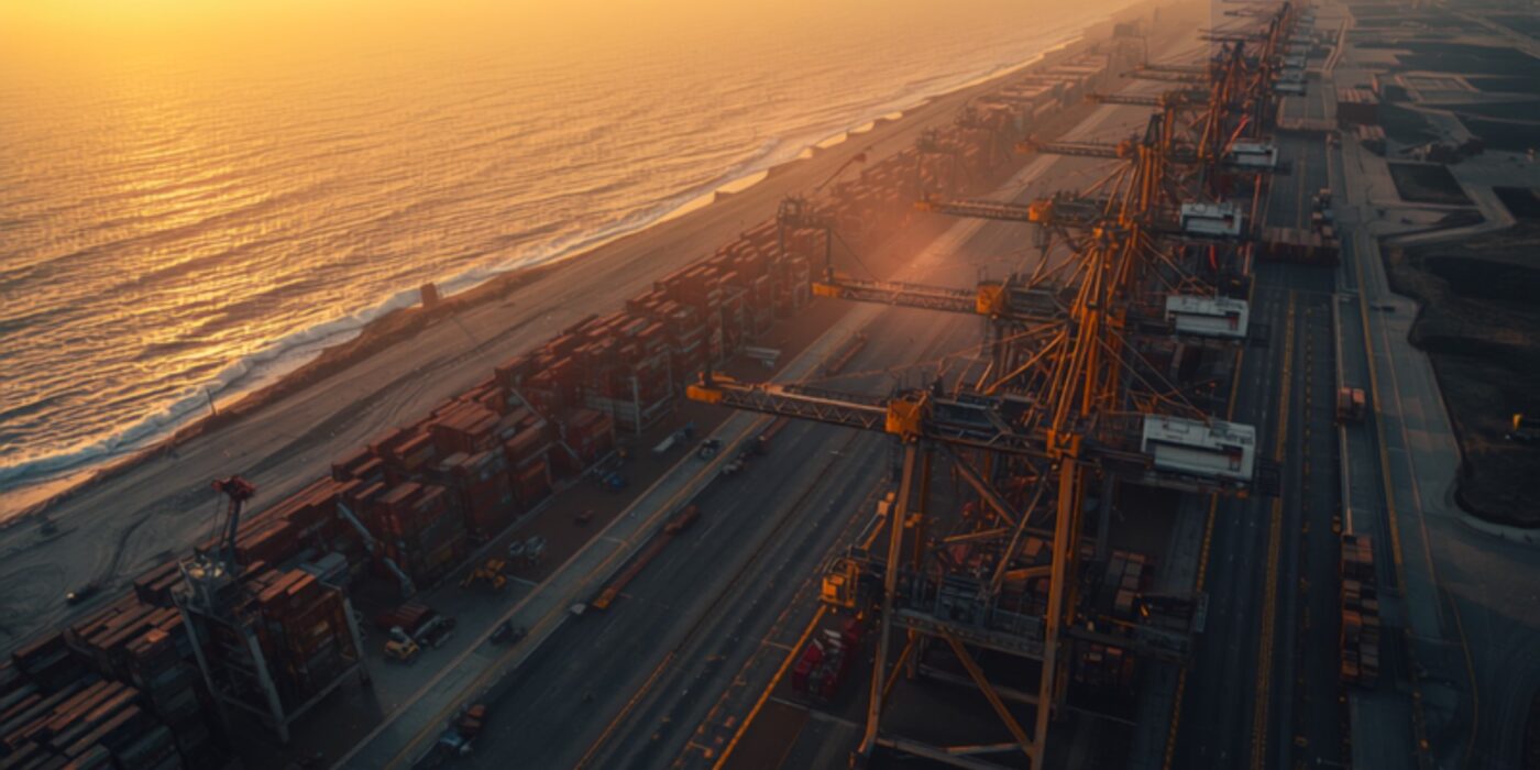
Aerial view of a large container port at sunrise with rows of cargo cranes and stacked shipping containers along a coastline
CategoriesMumbai 3.0

Vadhavan Port & North MMR Land Values: Investment Analysis 2026–2034

Reading time: 14 minutes | Last updated: July 2026 | Author: Girish Chhalwani, Founder & CEO, THE EDGE Developments

TL;DR — Key Takeaways

  • Vadhavan Port, near Dahanu in Palghar district, is India’s largest greenfield deep-water port project — approved at a total build cost of ₹76,220 crore, with the first phase (~₹45,000 crore, including ₹25,000 crore for land reclamation) already under construction since the groundbreaking by PM Narendra Modi on 30 August 2024.
  • It will be built and owned through a joint venture — Jawaharlal Nehru Port Authority (74%) and Maharashtra Maritime Board (26%) — with a designed capacity of 23.2 million TEUs and 298 MMT of cargo a year, making it larger than JNPT at full build-out.
  • Four of nine container terminals are targeted for commissioning by 2029; full completion is expected by 2034.
  • Connectivity is being built in parallel: a ₹2,881 crore, ~25 km road link to NH48 via Tarapur–Boisar/Chinchani–Vangaon/Dahanu (Bharatmala Pariyojana), a 12 km rail spur to the Western Dedicated Freight Corridor at New Palghar, and a ₹2,528.90 crore, 104.89 km freight expressway connecting the port directly to the Samruddhi Mahamarg at Bharvir (Nashik district).
  • This converts Dahanu–Boisar–Palghar–Vangaon from a low-density coastal belt into a logistics-and-industrial growth corridor — the same infrastructure-first sequencing that repriced Karjat, Uran, and Panvel over the last decade.
  • Land in Boisar currently trades around ₹1,500–4,200/sq.ft; interior Palghar/Vangaon parcels are available from roughly ₹500/sq.ft — a wide entry-price band that will compress as construction milestones (terminal commissioning, expressway opening) land between 2026 and 2029.

Executive Summary

Does Vadhavan Port change the investment case for land in Palghar district? Yes — Vadhavan Port is a ₹76,220 crore deep-water mega-port under construction near Dahanu, designed to handle 23.2 million TEUs a year, and it is being built alongside a dedicated freight rail spur, a new NH48 link road, and a 105 km expressway to the Samruddhi Mahamarg. Together, these projects create the same “infrastructure precedes density” pattern that has already repriced Karjat, Panvel, and Uran in the Mumbai Metropolitan Region (MMR) — except this time the growth corridor runs north, through Boisar, Dahanu, Vangaon, and Palghar town, not south-east.

For THE EDGE’s readership — land investors, second-home buyers, and developers tracking Mumbai 3.0’s outward expansion — Vadhavan Port is the single largest infrastructure catalyst in the northern MMR that does not yet have a dedicated body of investment research. This article maps the project’s engineering scope, its connectivity build-out, its realistic timeline, and — most importantly — which micro-markets around it are positioned to benefit, and on what schedule.

Introduction: Why a Port 120 KM from Mumbai Matters to MMR Land Investors

Every prior wave of Mumbai’s outward growth has followed the same sequence: a transport or logistics anchor gets sanctioned, connectivity infrastructure follows within a few years, and land values in the surrounding villages re-rate long before the anchor project itself is operational. The Navi Mumbai International Airport (NMIA) did this for Panvel, Uran, and Karjat. The Virar–Alibaug Multimodal Corridor is doing it for Karjat and Khopoli. Vadhavan Port is now doing it for the Palghar coastal belt — a region that, until the environment and defence ministries cleared the project in early 2025, had almost no institutional land-investment coverage.

Vadhavan is not a small port expansion. At a designed capacity of 23.2 million TEUs, it would rank among the ten largest container ports in the world once fully built — larger than the existing Jawaharlal Nehru Port (JNPT) it is designed to relieve. Unlike JNPT, which sits inside the increasingly congested Navi Mumbai–Uran industrial belt, Vadhavan is being built on greenfield coastal land specifically because it offers natural deep draft (allowing the largest container vessels to dock without dredging) and space for large-scale reclamation.

What Is Vadhavan Port? Key Facts at a Glance

Attribute Detail
Location Vadhavan village, Dahanu taluka, Palghar district, Maharashtra
Project type Greenfield all-weather deep-water container port
Total build cost ₹76,220 crore (Phase 1 estimated at ~₹45,000 crore, including ₹25,000 crore for land reclamation)
Ownership structure Jawaharlal Nehru Port Authority (JNPA) — 74%; Maharashtra Maritime Board — 26% (public-private partnership)
Designed capacity 23.2 million TEUs/year; 298 MMT cumulative cargo/year
Groundbreaking 30 August 2024 (Prime Minister Narendra Modi)
Phase 1 terminals 4 of 9 container terminals targeted by 2029
Full completion 2034 (remaining 5 terminals)
Primary road link ~25 km, ₹2,881 crore link to NH48 via Tarapur–Boisar / Chinchani–Vangaon / Dahanu (Bharatmala Pariyojana)
Rail link 12 km spur connecting to the Western Dedicated Freight Corridor at the proposed New Palghar station
Expressway link 104.89 km, ₹2,528.90 crore high-speed freight corridor to the Samruddhi Mahamarg at Bharvir, Nashik district (targeted within 3 years of sanction)

Sources: JNPA official project page; Ministry of Ports, Shipping and Waterways approvals; NHAI Bharatmala sanctions; Maharashtra government expressway approval, reported via Maritime Gateway and Free Press Journal.

Vadhavan vs India’s Other Major Container Ports

Port State Status (2026) Approx. annual capacity Water depth
Jawaharlal Nehru Port (JNPT) Maharashtra Operational since 1989, near capacity ~10 million TEUs Requires dredging; draft-limited for largest vessels
Mundra Port Gujarat Operational, India’s largest private port ~10+ million TEUs (all cargo types) Natural deep draft
Vadhavan Port Maharashtra Under construction (Phase 1) 23.2 million TEUs (designed, full build-out) Natural deep draft — no dredging required

Mumbai 3.0’s Northern Extension: Positioning Palghar in the MMR Growth Story

THE EDGE’s Mumbai 3.0 framework has tracked the Mumbai Metropolitan Region’s outward expansion primarily along its south-eastern axis — Karjat, Khopoli, Panvel, and Uran — driven by the Navi Mumbai International Airport and the Virar–Alibaug Multimodal Corridor. Vadhavan Port introduces a second, largely independent axis: the northern coastal corridor through Vasai-Virar, Palghar, Boisar, and Dahanu. Industry commentary has already begun referring to this as “Mumbai 4.0” — a separate growth wave layered on top of Mumbai 3.0, driven by port logistics and freight economics rather than aviation and residential decongestion.

Who Should Consider This Corridor

Investor profile Fit for Vadhavan corridor Notes
Long-horizon land investor (7–10+ years) Strong fit Aligns with the project’s own 2029/2034 milestone structure
Industrial/warehousing developer Strong fit, near-term Tarapur MIDC base plus new freight links create early demand even before port commissioning
Short-horizon flipper (1–3 years) Weak fit Re-rating is likely to track construction milestones over several years, not months
NRI investor seeking a second home Weak-to-moderate fit This is fundamentally an industrial/logistics corridor, not a lifestyle or weekend-home destination like Karjat or Alibaug
First-time land buyer without local legal support Proceed with caution Coastal Konkan title verification (CRZ, fragmented holdings) requires stronger legal diligence than inland MMR corridors

Step-by-Step Due Diligence Checklist Before Buying Near Vadhavan Port

  1. Pull the 7/12 extract (Satbara Utara) for the specific survey number from the Mahabhulekh portal to confirm current ownership, area, and land-use classification.
  2. Confirm NA (Non-Agricultural) status or convertibility — agricultural land cannot be legally built on or easily financed until converted.
  3. Obtain CRZ classification from the Maharashtra Coastal Zone Management Authority for the exact plot — this determines what, if anything, can be built.
  4. Cross-check the plot against NHAI, MMRDA, and Palghar collector project maps to rule out overlap with the port, expressway, or rail acquisition boundaries.
  5. Request a 30-year title search through a local advocate to rule out inheritance disputes, which are common in fragmented Konkan coastal holdings.
  6. Verify encumbrances via the Index II record and CERSAI mortgage database.
  7. Physically inspect the plot and its road access — brochure “port-adjacent” claims should always be checked against the actual sanctioned road alignment, not assumed.

Micro-Market Impact Map: Where the Opportunity Sits

Micro-market Distance from port site Current land rate (approx.) Primary driver Investment horizon
Boisar ~15–20 km ₹1,500–4,200/sq.ft Existing MIDC industrial base + direct expressway link Near-term (2026–2029)
Dahanu / Vadhavan periphery 0–10 km Wide range; port-adjacent land largely under acquisition/CRZ restriction Direct port employment and ancillary logistics Medium-term, acquisition-sensitive
Vangaon ~10–15 km From ~₹500/sq.ft (interior parcels) Road alignment (Chinchani–Vangaon link) + rail spur Early-stage, higher risk/reward
Palghar town ~20–25 km Mid-range, town-core premium DFC rail station, district administrative hub Medium-term
Tarapur (MIDC) ~15 km Established industrial rates Existing chemical/industrial cluster + new freight link Near-term, industrial-only

Expert Opinion

“Every large Indian port has followed the same repricing curve — the land 15 to 25 kilometres out moves first, on the connectivity build-out, well before the port itself is operational. Vadhavan is at the stage Uran was in 2016: the sanction is real, the connectivity contracts are being awarded, and the land is still priced for a coastal fishing belt, not a logistics corridor. That gap is the opportunity — and it is also exactly where the risks of unclear title and premature ‘confirmed port-adjacent’ claims from local brokers are highest.” — Girish Chhalwani, Founder & CEO, THE EDGE Developments

Pros and Cons of Investing Near Vadhavan Port Today

Pros Cons / Risks
Confirmed central government approval and active construction (not a proposal stage) Full port completion is 2034 — this is a long-horizon thesis, not a 2–3 year flip
Three independent connectivity projects (road, rail, expressway) create multiple re-rating triggers, not just one CRZ (Coastal Regulation Zone) restrictions apply to large stretches of port-adjacent land, limiting buildability
Entry prices in Vangaon and interior Palghar remain low relative to comparable pre-infrastructure MMR corridors Land acquisition for the port and expressway has faced local opposition — creates local sentiment and delay risk
Existing Tarapur MIDC industrial base provides an established economic anchor Title verification is materially harder in coastal Konkan belts — always confirm NA status and CRZ classification before purchase

Risk Factors Investors Must Verify Before Buying

  • CRZ classification: Coastal Regulation Zone rules restrict construction close to the shoreline. Always obtain the CRZ classification of a specific plot before assuming buildability.
  • NA (Non-Agricultural) conversion status: As with any Maharashtra land purchase, agricultural land cannot be legally built on, sold to non-farmers in most cases, or bank-financed until converted to NA status.
  • Acquisition overlap: Confirm the specific plot is not inside a notified land-acquisition boundary for the port, expressway, or rail corridor.
  • Broker “port-adjacent” claims: Verify actual distance, road alignment, and CRZ status independently rather than relying on brochure maps.
  • Execution risk: Large infrastructure projects in India frequently see multi-year slippage. Treat the 2029/2034 dates as directional, not contractual.

Actionable Insights for Land Investors

  1. Prioritise the connectivity corridor over the port boundary. Land along the confirmed road alignment carries lower acquisition-overlap risk than land immediately adjacent to the port.
  2. Verify CRZ and NA status before any commitment — this single step eliminates the majority of coastal-belt land disputes.
  3. Treat 2026–2029 as the accumulation window, based on the JNPT-Uran precedent, where connectivity milestones drove the sharpest re-rating.
  4. Favour NA-converted or conversion-ready plots with clean title over speculative “future port-adjacent” agricultural parcels.
  5. Track the Samruddhi Mahamarg freight-link progress as a leading indicator of Vadhavan’s expanding industrial catchment.

Conclusion

Vadhavan Port is the largest and least-covered infrastructure catalyst currently reshaping Maharashtra’s coastal land map. It will not transform Palghar overnight — full commissioning stretches to 2034 — but the connectivity infrastructure being built in parallel is a near-term, verifiable, and already-funded trigger. For investors applying the same infrastructure-first discipline that has worked in Karjat, Uran, and Panvel, the Boisar–Vangaon–Palghar corridor deserves the same rigorous, document-first due diligence — and belongs on the watchlist for Mumbai 3.0’s next growth wave.

Frequently Asked Questions

What is Vadhavan Port and where is it located?

Vadhavan Port is a greenfield deep-water container port being built near Vadhavan village in Dahanu taluka, Palghar district, Maharashtra, roughly 120 km north of Mumbai.

How much does the Vadhavan Port project cost?

The full build-out is estimated at ₹76,220 crore, with the initial phase (including ₹25,000 crore for land reclamation) estimated around ₹45,000 crore.

When will Vadhavan Port be completed?

Four of nine planned container terminals are targeted for commissioning by 2029, with full completion of all nine terminals expected by 2034.

Which areas will benefit most from Vadhavan Port?

Boisar, Dahanu, Vangaon, Palghar town, and the existing Tarapur MIDC belt are the primary micro-markets positioned to benefit, largely along the confirmed road and rail alignments.

What are current land prices near Vadhavan Port?

Boisar land trades around ₹1,500–4,200/sq.ft; more interior parcels in areas like Vangaon are available from roughly ₹500/sq.ft, though prices vary widely by proximity to sanctioned infrastructure.

Should I buy land right next to the port, or further inland?

The more replicable, lower-risk opportunity — based on how JNPT and Uran actually repriced — lies 10–25 km out along the confirmed connectivity corridor, not directly at the port boundary.

What is the realistic investment horizon for this corridor?

Given the 2029/2034 milestone dates, this is a 7–10 year structural thesis, with the 2026–2029 window most relevant for entry based on connectivity-linked re-rating.

Citations & Sources

  1. Jawaharlal Nehru Port Authority — official Vadhavan Port project page (jnport.gov.in)
  2. The Week — “Unpacking Vadhavan port: How India’s new mega port is being built and financed” (September 2025)
  3. Upstox — “Centre approves ₹76,200 crore Vadhavan Port Project in Maharashtra”
  4. Maritime Gateway — “Last mile connectivity to Vadhavan Port”
  5. Free Press Journal — “NHAI Approves ₹2,360 Crore Vadhavan Port Expressway In Palghar”; “Mumbai 4.0 Takes Shape In Palghar”
  6. 99acres — Boisar, Palghar property rate trends 2026

Explore the Vadhavan Corridor with Local Expertise

THE EDGE Developments tracks infrastructure-led land opportunities across the Mumbai Metropolitan Region, including the emerging Palghar coastal corridor.

Contact: connect@theedgedevelopments.com | +91-9664662938 | edgere.in


Title slide over a dusk Mumbai cityscape: 'Land Price Forecast Near Mumbai 2026–2031' (THE EDGE) with 'DEVELOPMENTS' text subtly visible.
CategoriesMumbai 3.0

Land Price Forecast Near Mumbai 2026–2031: What Infrastructure Data Predicts

THE EDGE — Direct Answer

Land prices near Mumbai are forecast to appreciate 14–22% CAGR through 2031, driven by five funded infrastructure projects: the Navi Mumbai International Airport (now operational), the Virar–Alibaug Multimodal Corridor (VAMC, 60% built, due 2028–2030), the Second Mumbai–Pune Expressway (45% built, due 2027–2029), the Thane–Diva–Panvel rail corridor, and Metro Line 12. Every major MMR infrastructure opening in the last 30 years — Bandra–Worli Sea Link, Eastern Freeway, JNPT expansion — triggered a 25–65% price step-change in adjacent land within 24–36 months of completion. Karjat leads the forecast at 18–22% CAGR (three simultaneous catalysts), followed by Khopoli at 16–20%, Panvel–Uran at 14–18%, and Alibaug at 12–16%. Investors who enter before a project completes capture the full appreciation curve — mid-2026 is still pre-completion for the VAMC and Second Expressway.

TL;DR — KEY TAKEAWAYS

  • Land near Mumbai is forecast to appreciate 14–22% CAGR through 2031 across the main infrastructure corridors.
  • Karjat leads the base case (18–22% CAGR) with three simultaneous catalysts — VAMC, Second Expressway, and NMIA.
  • Every past MMR infrastructure opening triggered a 25–65% price step-change within 24–36 months.
  • Main risks: infrastructure delays, economic slowdown, and interest-rate spikes.

Land prices near Mumbai are forecast to appreciate 14–22% CAGR through 2031 across the primary infrastructure corridors — driven by the VAMC, the Second Mumbai–Pune Expressway, NMIA maturation, and continued NRI demand. The forecasts are not speculative — they are derived from infrastructure delivery timelines, historical price correlation with MMR project completions, and current market fundamentals.

Reading time: 13 minutes | Last updated: July 2026 | Author: Girish Chhalwani, Founder & CEO, THE EDGE Developments

Every major infrastructure completion event in MMR history has been followed by a 25–50% land price step-change in the immediately adjacent corridor within 24 months of project opening. The Bandra–Worli Sea Link appreciated Worli and Lower Parel real estate 60–80% in its first 3 years post-opening. The Eastern Freeway did the same for Chembur and Mankhurd. NMIA is now live. VAMC is next. — Source: ANAROCK Historical Infrastructure Impact Analysis, NIC Research 2025

What is Mumbai 3.0 and why does it matter?

Mumbai 3.0 is the third spatial expansion of the city — from the island core (1.0) to Navi Mumbai (2.0) and now into Karjat, Alibaug, Pen, Uran and Khopoli (3.0). It is being enabled entirely by infrastructure, which makes the expansion — and the land appreciation that follows it — largely inevitable.

  • Mumbai 1.0 (Pre-2000): Island city + immediate suburbs (Dadar, Andheri, Thane)
  • Mumbai 2.0 (2000–2020): Navi Mumbai, Kharghar, Panvel, Dombivali, Badlapur
  • Mumbai 3.0 (2020–2035): Karjat, Alibaug, Pen, Uran, Khopoli, Virar North, Vasai–Virar expansion

Mumbai 3.0 is being enabled entirely by infrastructure. Without the VAMC, the Second Expressway, and NMIA, this expansion would not be happening. With them, it is inevitable.

What are the 5 infrastructure triggers and their timelines?

Five funded projects drive the forecast — NMIA (operational), the VAMC (60% built), the Second Expressway (45%), the Thane–Diva–Panvel rail corridor, and Metro Line 12 — each with a mapped impact zone and expected price step-change.

Project Status (July 2026) Completion Est. Primary Impact Zone Expected Price Impact
Navi Mumbai International Airport Operational (Phase 1) Phase 2: 2028 Panvel, Uran, Dronagiri, Karjat 30–50% step-change already begun
Virar–Alibaug Multimodal Corridor Under construction (60%) 2028–2030 Alibaug, Pen, Karjat, Khopoli, Panvel 40–60% step-change expected at completion
Second Mumbai–Pune Expressway Under construction (45%) 2027–2029 Karjat, Khalapur, Khopoli 25–40% step-change expected
Thane–Diva–Panvel Rail Corridor Under construction 2027–2028 Thane, Panvel, Diva 15–25% step-change
Metro Line 12 (Kalyan–Taloja) Under development 2028–2030 Kalyan, Ambernath, Taloja 20–35% step-change

What are the location-specific forecasts for 2026–2031?

Karjat leads at 18–22% CAGR, Khopoli 16–20%, Panvel–Uran 14–18%, and Alibaug 12–16% — with lower-entry corridors offering the highest percentage upside.

Karjat: Base Case 18–22% CAGR

Three simultaneous infrastructure tailwinds (VAMC, Second Expressway, NMIA proximity) make Karjat the strongest forecast corridor for 2026–2031. The base case assumes both VAMC and Second Expressway deliver by 2029–2030. Current entry prices of ₹900–2,500/sq.ft for NA plots are forecast to reach ₹2,500–6,500/sq.ft by 2031 in the base case.

Panvel–Uran: Base Case 14–18% CAGR

With NMIA now live, the step-change has already begun. Significant further upside remains as Phase 2 capacity and commercial ecosystem builds around the airport. Residential land at ₹2,500–6,000/sq.ft is forecast at ₹5,500–12,000/sq.ft by 2031.

Alibaug: Base Case 12–16% CAGR

Strong demand floor from HNI/celebrity market. VAMC connectivity will unlock wider residential demand. Entry prices are already high; moderate CAGR with strong absolute price growth expected. ₹5,000–10,000/sq.ft forecast to ₹10,000–22,000/sq.ft by 2031.

Khopoli: Base Case 16–20% CAGR

The Second Expressway is the primary catalyst. Lower entry price means higher percentage upside. Currently ₹600–1,500/sq.ft, forecast to ₹1,500–3,500/sq.ft by 2031.

What does historical infrastructure data show about price formation?

Five verified MMR case studies confirm the pattern — each major project opening drove a 45–200% appreciation in its adjacent corridor.

  1. Bandra-Worli Sea Link (2009): Worli sea-facing properties appreciated 65% within 36 months
  2. Eastern Freeway (2013): Chembur residential land appreciated 45% within 24 months
  3. JNPT Expansion (2017–2020): Uran, Dronagiri land appreciated 80–120% as JNPT scaled
  4. Metro Line 1 Versova–Andheri–Ghatkopar (2014): Ghatkopar commercial 60% appreciation within 5 years
  5. Navi Mumbai CBD / Kharghar (2005–2015): CIDCO-developed areas appreciated 200%+ as infrastructure completed

What are the risks to this forecast?

Forecasts are not guarantees. The key downside risks are infrastructure delays, an economic slowdown, an interest-rate spike, and regulatory or zoning changes.

  • Infrastructure delays: VAMC and Second Expressway are large, complex projects. Delays of 2–3 years are possible.
  • Economic slowdown: A global or India-specific recession could dampen NRI investment and domestic demand
  • Interest rate spike: If RBI rates rise sharply, plot loan affordability reduces
  • Regulatory risk: New environmental restrictions, forest protection orders, or zoning changes could affect certain micro-markets

Frequently Asked Questions

What will land prices near Mumbai be in 2031?

Under the base case (14–20% CAGR), NA plot prices in Karjat are forecast to reach ₹2,500–6,500/sq.ft by 2031, up from ₹900–2,500 in 2026. Panvel corridor plots could reach ₹5,500–12,000/sq.ft. These are projections based on infrastructure timelines and historical correlations — not guarantees.

Which area near Mumbai will appreciate the most by 2031?

Based on infrastructure timing and current price entry points, Karjat and Khopoli offer the highest percentage appreciation potential by 2031. Panvel–Uran offers the most reliable appreciation given the already-operational NMIA, but current prices are higher.

How does infrastructure affect land prices?

Infrastructure reduces effective distance — when travel time from a peripheral location to Mumbai drops from 90 minutes to 45 minutes, that location effectively moves “closer” to Mumbai. This expansion of the effective economic boundary creates demand for a fixed supply of land, directly driving up prices. Historical MMR case studies show a 25–65% appreciation step-change within 24–36 months of major infrastructure opening.

Is it too late to invest near Mumbai before VAMC completes?

No — mid-2026 is still in the construction phase of the VAMC. The largest appreciation events historically occur in the 12–24 months before and after completion. Investors entering now are still ahead of the completion-event step-change.

About the Author — Girish Chhalwani

Girish Chhalwani is the Founder & CEO of THE EDGE Developments, a RERA-registered plotted-development company in the Karjat–MMR corridor. With 20+ years in Maharashtra land acquisition, NA conversion, and infrastructure-led land investment, he advises HNI and NRI investors on land strategy near Mumbai.

 ·  About THE EDGE Developments

Position Ahead of the Mumbai 3.0 Infrastructure Wave

THE EDGE Developments offers RERA-registered plots in the Karjat corridor — at the intersection of VAMC, the Second Expressway, and NMIA. Speak with our team about entering before the completion step-change.

Book a Consultation →