

Crowd outside district collectorate building
CategoriesLand Investment

Revenue Resolution Campaigns: Bawankule’s 2026 District-Level Land Dispute Drives

Key Takeaways

  • Revenue Minister Chandrashekhar Bawankule has directed district-level “revenue resolution” campaigns aimed at clearing backlogs of pending mutation entries, land record disputes, and revenue applications.
  • These time-bound drives typically involve concentrated administrative effort at the district and taluka level to process a large volume of pending cases within a defined window.
  • For landholders with long-pending mutation or correction applications, these campaigns represent a practical opportunity to get stalled cases resolved faster than the standard ongoing process.
  • Land buyers evaluating a property with a known pending dispute or application should check whether a current or recent resolution campaign covers that district or taluka.

Reading time: 6 min | Last updated: July 2026 | By Girish Chhalwani, Founder & CEO, THE EDGE Developments

Revenue resolution campaigns are time-bound administrative drives directed by Revenue Minister Chandrashekhar Bawankule to clear backlogs of pending land record disputes, mutation entries, and revenue applications at the district and taluka level. Maharashtra’s revenue administration, like many large bureaucratic systems, accumulates pending cases over time — mutation entries stuck in process, boundary disputes awaiting resolution, correction applications sitting in queue. These campaigns concentrate administrative resources to work through such backlogs within a defined timeframe, rather than relying solely on routine day-to-day processing.

What These Campaigns Typically Address

Category Examples
Pending mutation entries Mutation applications filed but not yet certified due to backlog
Boundary/measurement disputes Long-pending survey or boundary disagreement cases
Record correction applications Requests to fix factual errors in 7/12, 8A, or Property Card records
NA conversion backlogs Pending applications for non-agricultural conversion status

Why This Matters for Landholders and Buyers

  • Faster resolution window. If you have a long-pending application in a district running an active campaign, this is a genuinely favorable window to push for resolution.
  • Due diligence signal. When evaluating land in a district with a known pending dispute, checking whether a resolution campaign is active or recently concluded can help gauge how quickly that specific issue might be resolved.
  • Cleaner records going forward. As backlogs clear, the overall reliability of land records in affected districts should improve, benefiting future due diligence broadly.

“These campaigns come and go by district, and timing matters. If you’ve got a pending mutation or correction stuck in the system, it’s worth checking whether your district has an active resolution drive — that can be the difference between months of waiting and getting it cleared in weeks.” — Girish Chhalwani, Founder & CEO, THE EDGE Developments

How to Take Advantage of an Active Campaign

  1. Check with the local Tehsildar or district Collector’s office whether a revenue resolution campaign is currently active in your district.
  2. If you have a pending mutation, correction, or dispute case, confirm it’s registered and flagged for review during the campaign window.
  3. Follow up proactively rather than assuming inclusion is automatic — campaigns typically process a high volume of cases and squeaky wheels get addressed faster.

How Resolution Campaigns Connect to Decentralized Authority

Revenue resolution campaigns work more effectively when paired with Bawankule’s parallel push for revenue decentralization — shifting certain approval authority from district Collector offices to taluka-level Tehsildar offices. A backlog-clearing campaign concentrated at the district level can only move so fast if every case still has to route through a single, centralized approval chain; decentralized authority gives taluka offices more room to actually clear cases locally during a campaign window rather than escalating everything upward. Landholders with a pending case should check whether both initiatives are active in their district, since the combination is what actually determines how quickly a long-stalled case gets resolved.

FAQ

What are revenue resolution campaigns?

They are time-bound administrative drives directed by the Revenue Ministry to clear backlogs of pending land record disputes, mutations, and applications at the district level.

What kinds of cases do these campaigns address?

Pending mutation entries, boundary disputes, record correction applications, and NA conversion backlogs, among other revenue administration matters.

How do I know if my district has an active campaign?

Check directly with the local Tehsildar or district Collector’s office for current campaign status and coverage.

Should I follow up on a pending case during a campaign window?

Yes — proactively confirming your case is registered and flagged for review is advisable rather than assuming automatic inclusion.

Citations & Sources

  • Maharashtra Revenue & Forest Department, 2026 policy announcements
  • Office of the Revenue Minister, Government of Maharashtra

Related Reading

Have a Pending Land Record Case? We Can Help Navigate It

THE EDGE Developments tracks district-level administrative campaigns that could help resolve your pending land record matters faster.

connect@theedgedevelopments.com | Phone: +91-9664662938
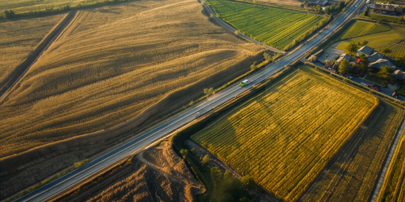
Rural road construction through farmland connecting villages
CategoriesLand Investment

Baliraja Panand Raste Yojana: Bawankule’s 2026 Push for Farm Access Road Records

Key Takeaways

  • The Baliraja Panand Raste Yojana is a Maharashtra government scheme focused on developing and formally recording “panand rastas” — farm access roads that connect individual agricultural plots to the main village road network.
  • Many agricultural plots historically relied on informal, undocumented access paths, which has created disputes when neighboring landholders block or alter these paths.
  • Formalizing panand rasta records under this scheme, pushed forward as part of Revenue Minister Chandrashekhar Bawankule’s 2026 initiatives, gives farmers documented legal access rights, not just customary use.
  • For land buyers, confirming that a plot has a formally recorded access road — not just an informal path — is an important and often overlooked due-diligence item, especially for interior agricultural plots.

Reading time: 6 min | Last updated: July 2026 | By Girish Chhalwani, Founder & CEO, THE EDGE Developments

The Baliraja Panand Raste Yojana addresses a practical but often overlooked problem in Maharashtra’s rural land ecosystem: many agricultural plots depend on informal farm access roads (panand rastas) that were never formally recorded, leaving farmers vulnerable to access disputes when a neighboring landholder blocks or alters the path. As part of Revenue Minister Chandrashekhar Bawankule’s 2026 land record push, formalizing these access roads has direct relevance not just to farmers using them daily, but to anyone buying interior agricultural land that depends on such a path for basic access.

What Is a Panand Rasta?

A panand rasta is a farm access road or path — often informal, sometimes just a customary right-of-way across or between plots — that connects individual agricultural fields to the main village road network. These paths have traditionally existed by convention rather than formal legal documentation, which has worked reasonably well in stable rural communities but creates real problems when land changes hands, family disputes arise, or a neighboring landholder decides to obstruct the path.

What the Scheme Aims to Do

Focus Benefit
Physical road development Improving the actual condition of farm access roads for better usability, especially during monsoon
Formal record-keeping Documenting the access road’s existence and route in land records, giving it legal standing
Dispute reduction Reducing access-blocking disputes by giving farmers documented rights rather than relying on informal custom

Why This Matters for Land Buyers

  • Interior plots depend entirely on access. A plot with excellent soil and location is worth far less if there’s no reliable, legally recognized way to reach it — confirming a formally recorded access road is essential due diligence, not a minor detail.
  • Informal access is a real risk. If a plot’s only access is an informal path across a neighbor’s land with no documentation, that access can be legally challenged or physically blocked after purchase, leaving the buyer with a landlocked or difficult-to-reach plot.
  • Formal records add resale value. A plot with documented, legally recognized access is inherently more marketable and bankable than one relying on undocumented customary use.

“Access is one of those things buyers assume is fine because they drove up to the plot during a site visit. But if that access road isn’t formally recorded, it can be contested or blocked later, and you’d be surprised how often that happens between neighbors who don’t get along. Ask specifically whether the access path to an interior plot is documented, not just whether it currently exists.” — Girish Chhalwani, Founder & CEO, THE EDGE Developments

How to Check Access Road Status Before Buying

  1. Confirm whether the plot’s access road is formally recorded in land records or under the Baliraja Panand Raste Yojana specifically.
  2. If informal, ask the seller and, ideally, the local Talathi about the history and stability of that access arrangement.
  3. Cross-check the access route against the Bhunaksha map to understand exactly how the path relates to neighboring survey numbers.
  4. For interior plots with no confirmed formal access, factor this risk explicitly into your valuation and negotiation.

Access Roads as Part of the Broader Pre-Purchase Verification Push

Farm access road documentation sits alongside two other 2026 reforms that share the same underlying goal: confirming physical, on-ground reality before a transaction closes rather than after. The “measure first, register later” sequencing reform applies this exact logic to plot boundaries and area — verify the physical facts, then register. Water body boundaries are undergoing the same treatment under the Water 7/12 initiative. Buyers evaluating an interior agricultural plot should treat access road status as one item on the same due-diligence checklist as boundary and water-body verification — none of these checks are optional extras; together they confirm the plot is actually what it appears to be on paper.

FAQ

What is the Baliraja Panand Raste Yojana?

It’s a Maharashtra government scheme focused on developing and formally recording farm access roads (panand rastas) that connect agricultural plots to the main road network.

What is a panand rasta?

A panand rasta is a farm access road or path, often informal, connecting individual agricultural fields to the village road network.

Why does formal documentation of access roads matter?

Without formal records, access paths rely on informal custom, which can be disputed or blocked by neighboring landholders, leaving a plot difficult to reach.

How do I check if a plot has documented access?

Verify with the local Talathi office and cross-check the access route against a Bhunaksha map before purchasing an interior agricultural plot.

Should I be concerned about buying land with only informal access?

Yes — informal, undocumented access carries real risk of future disputes or obstruction, and should be factored into your due diligence and valuation.

Citations & Sources

  • Maharashtra Revenue & Forest Department, 2026 policy announcements
  • Office of the Revenue Minister, Government of Maharashtra

Related Reading

Interior Plot? We Verify Access Before You Buy

THE EDGE Developments confirms formal access road status on every interior agricultural plot we recommend.

connect@theedgedevelopments.com | Phone: +91-9664662938

Irrigation canal winding through green farmland
CategoriesLand Investment

Water 7/12: Bawankule’s 2026 Initiative to Record Water Body Boundaries on Land Records

Key Takeaways

  • The “Water 7/12” initiative, part of Revenue Minister Chandrashekhar Bawankule’s 2026 land record reforms, focuses on formally documenting the boundaries of water bodies — ponds, streams, canals, nullahs — within the standard land record system.
  • Historically, many water body boundaries have been poorly documented or encroached upon over time, since they didn’t always receive the same rigorous record-keeping as agricultural or residential plots.
  • Accurate water body boundary records matter directly to land buyers, since encroachment onto or near a water body can create legal, environmental, and flood-risk complications for adjacent land.
  • Buyers evaluating land near ponds, streams, or canals should specifically check whether the water body’s boundary is accurately recorded and whether any part of the plot in question falls within a protected buffer zone.

Reading time: 6 min | Last updated: July 2026 | By Girish Chhalwani, Founder & CEO, THE EDGE Developments

The “Water 7/12” initiative under Revenue Minister Chandrashekhar Bawankule aims to formally document the boundaries of water bodies — ponds, streams, canals, and similar features — within Maharashtra’s standard land record system, addressing a long-standing gap where such boundaries were often poorly recorded or encroached upon. For land buyers, this matters more than it might initially appear: land adjacent to or near a poorly documented water body carries real legal and environmental risk, from encroachment disputes to flood-zone complications.

Why Water Body Boundaries Have Been a Documentation Gap

Unlike agricultural or residential plots, which have historically received detailed survey and record attention, water bodies — particularly smaller ponds, seasonal streams, and irrigation channels — have often lacked the same rigor in boundary documentation. Over time, this gap has allowed gradual encroachment in some areas, where adjacent landholders extend cultivation or construction into what was originally water body land, sometimes without formal challenge due to the absence of clear recorded boundaries.

What the Water 7/12 Initiative Aims to Fix

Focus Area Intended Outcome
Boundary documentation Formal recording of water body extents alongside standard land records
Encroachment identification Clearer baseline to identify and address unauthorized encroachment on water body land
Buffer zone clarity Better-defined protected zones around water bodies, relevant to construction and land-use restrictions

Why This Matters for Land Buyers

  • Encroachment risk assessment. Land adjacent to a water body with unclear boundaries carries risk that part of what’s being sold may actually fall within (or too close to) the water body’s rightful extent, which can complicate future use or trigger regulatory action.
  • Flood and environmental risk. Accurate water body records help clarify natural drainage patterns and flood-prone zones, relevant to both construction feasibility and insurance/risk considerations.
  • Buffer zone construction restrictions. Many water bodies carry regulatory buffer zones restricting construction within a certain distance — buyers need to confirm a plot doesn’t fall within such a restricted zone.

“Land next to a pond or stream can look idyllic in a listing photo, and it’s exactly the kind of plot where boundary documentation has historically been weakest. If the water body’s own boundary was never properly recorded, you don’t actually know where ‘your’ land ends and the water body’s legal extent begins. Get this specifically checked before buying anything adjacent to water.” — Girish Chhalwani, Founder & CEO, THE EDGE Developments

What Buyers Should Check for Land Near Water Bodies

  1. Request confirmation of the water body’s recorded boundary relative to the plot being purchased, ideally cross-referenced against a current Bhunaksha map.
  2. Confirm whether any regulatory buffer zone applies, and whether the plot’s usable/constructible area accounts for it.
  3. Ask whether any part of the historical water body extent may have been informally encroached into the plot being sold.
  4. Where uncertainty exists, request written clarification from the local Talathi or relevant water resources authority before proceeding.

How Water Body Records Fit the Wider 2026 Survey Push

Water 7/12 isn’t a standalone initiative — it rides on the same digital survey infrastructure being rolled out for standard land measurement. Faster government survey turnaround means water body boundary confirmation can realistically be completed alongside a standard plot survey rather than requiring a separate, slower process. Similarly, farm access road documentation under the Baliraja Panand Raste Yojana reflects the same underlying philosophy: land features that were historically left undocumented — access paths, water boundaries — are now being folded into the same formal record-keeping standard applied to the plots themselves. For buyers, this means a growing share of the practical, on-ground features that actually determine a plot’s usability are becoming independently verifiable rather than something you had to take on faith during a site visit.

FAQ

What is the Water 7/12 initiative?

It’s a 2026 Revenue Department initiative under Minister Bawankule aimed at formally documenting water body boundaries — ponds, streams, canals — within Maharashtra’s standard land record system.

Why haven’t water body boundaries been well documented historically?

They typically received less rigorous survey attention than agricultural or residential plots, allowing boundary ambiguity and, in some cases, gradual encroachment over time.

Why does this matter for someone buying land near a pond or stream?

Poorly documented water body boundaries create risk that part of the plot may fall within or too close to the water body’s legal extent, potentially triggering regulatory or encroachment issues later.

What is a buffer zone around a water body?

It’s a regulatory restricted zone around certain water bodies where construction is limited or prohibited, relevant to any land near ponds, streams, or canals.

How can I check if my plot falls within a water body buffer zone?

Cross-reference the plot against a current Bhunaksha map and, where uncertain, seek written clarification from the local Talathi or water resources authority.

Citations & Sources

  • Maharashtra Revenue & Forest Department, 2026 policy announcements
  • Office of the Revenue Minister, Government of Maharashtra

Related Reading

Buying Near Water? We Check the Boundary Twice

THE EDGE Developments verifies water body boundaries and buffer zone compliance on every waterside plot we recommend.

connect@theedgedevelopments.com | Phone: +91-9664662938

Digital scan overlay effect over golden farmland
CategoriesLand Investment

E-Mojani 2.0: Bawankule’s Upgraded Digital Land Survey Platform for Maharashtra

Key Takeaways

  • E-Mojani (Marathi for “e-measurement”) is Maharashtra’s digital land survey and measurement platform, using modern surveying technology (including GPS/GNSS-based tools) to replace older manual chain-and-tape survey methods.
  • The 2.0 upgrade, pushed forward under Revenue Minister Chandrashekhar Bawankule in 2026, focuses on faster processing, improved accuracy, and better integration with existing land record systems like 7/12 and Property Card data.
  • Digital survey methods reduce human error and processing time compared to traditional manual measurement, directly supporting related initiatives like the 30-day survey completion guarantee.
  • For land buyers, more accurate and faster digital surveys mean greater confidence in boundary and area data used during due diligence and transaction closing.

Reading time: 6 min | Last updated: July 2026 | By Girish Chhalwani, Founder & CEO, THE EDGE Developments

E-Mojani 2.0 is the upgraded version of Maharashtra’s digital land measurement and survey platform, part of a broader technology modernization push by Revenue Minister Chandrashekhar Bawankule aimed at making land surveys faster, more accurate, and better connected to the state’s existing digital land record ecosystem. Traditional land measurement using manual chain-and-tape methods has historically been slow and prone to human error; digital survey technology addresses both issues directly, with downstream benefits for anyone relying on accurate boundary and area data — which is to say, essentially every land buyer.

What E-Mojani Does

E-Mojani applies modern surveying technology — including GPS/GNSS-based measurement tools — to conduct land surveys with significantly improved speed and precision compared to traditional manual methods. Survey data captured digitally can be more readily cross-referenced against existing 7/12, 8A, and Property Card records, reducing the discrepancies that sometimes arise between older recorded measurements and current on-ground reality.

What’s New in the 2.0 Upgrade

Area of Improvement Focus
Processing speed Faster turnaround on survey requests, supporting the parallel 30-day survey guarantee initiative
Data integration Improved connectivity with 7/12, 8A, and Property Card systems for consistent record-keeping
Measurement accuracy Reduced margin of error compared to manual chain-and-tape methods

Why This Matters for Land Buyers

  • More reliable area and boundary data. Digital survey precision reduces the risk of buying land based on inaccurate or outdated area figures.
  • Faster resolution of measurement requests. A more efficient survey process directly supports quicker transaction timelines when a fresh survey is needed as part of due diligence.
  • Better cross-referencing with existing records. Improved integration means discrepancies between a plot’s recorded and actual measurements are more likely to surface and be resolved during the survey process itself.

“Manual survey methods have been a genuine source of measurement disputes for decades — a chain-and-tape measurement from forty years ago and a modern GPS-based measurement can legitimately produce different numbers. E-Mojani’s digital approach doesn’t eliminate every discrepancy, but it meaningfully reduces the room for measurement error going forward.” — Girish Chhalwani, Founder & CEO, THE EDGE Developments

What This Means for Survey Costs and Licensed Surveyors

Faster, more standardized digital measurement also has a knock-on effect on how survey work is priced and delivered. As E-Mojani reduces the time a government survey team spends per plot, it changes the calculus for when a buyer needs to pay for a supplementary private survey versus simply waiting for the standard government process. See our breakdown of current land measurement fees in Maharashtra for how government and private surveyor costs compare, and where digital tools are shifting that balance. For buyers on a tight transaction timeline, understanding both the government E-Mojani pathway and the licensed private surveyor option side by side is the practical way to decide which route gets you a verified measurement fastest.

FAQ

What is E-Mojani?

E-Mojani is Maharashtra’s digital land survey and measurement platform, using modern technology like GPS/GNSS tools instead of traditional manual chain-and-tape methods.

What’s different about E-Mojani 2.0?

The upgrade focuses on faster processing, improved measurement accuracy, and better integration with existing land record systems like 7/12 and Property Card data.

How does digital survey technology benefit land buyers?

It provides more reliable area and boundary data, faster turnaround on survey requests, and better cross-referencing with existing land records.

Does E-Mojani replace the need for a physical site survey?

No, it’s the technology used to conduct the survey itself — a physical measurement still occurs, but with modern digital tools rather than manual methods.

Is E-Mojani connected to the 30-day survey guarantee initiative?

Yes, faster digital processing under E-Mojani directly supports the broader push toward completing survey requests within a guaranteed timeline.

Citations & Sources

  • Maharashtra Revenue & Forest Department, 2026 policy announcements
  • Office of the Revenue Minister, Government of Maharashtra

Related Reading

Accurate Surveys Matter More Than You’d Think

THE EDGE Developments ensures every plot we recommend has verified, current measurement data before you buy.

connect@theedgedevelopments.com | Phone: +91-9664662938

Surveyors with drone equipment at golden hour
CategoriesLand Investment

30-Day Survey Guarantee: Bawankule’s 2026 Timeline Mandate for Land Measurement Requests

Key Takeaways

  • Revenue Minister Chandrashekhar Bawankule has directed a service-level commitment aiming to complete land survey and measurement requests within roughly 30 days of application, addressing long-standing delays in this process.
  • The mandate applies to standard land measurement/survey requests filed with the relevant Land Records office, using government surveyors or, where permitted, licensed private surveyors.
  • Delays in survey completion have historically held up land transactions, NA conversion applications, and boundary dispute resolution — a faster guaranteed timeline directly benefits buyers and sellers alike.
  • Landholders and buyers whose survey requests are delayed beyond the committed window should escalate through the relevant Land Records office or grievance channel rather than simply waiting indefinitely.

Reading time: 6 min | Last updated: July 2026 | By Girish Chhalwani, Founder & CEO, THE EDGE Developments

Revenue Minister Chandrashekhar Bawankule’s push for a 30-day service guarantee on land survey and measurement requests addresses one of the most persistent bottlenecks in Maharashtra’s land transaction process — the often lengthy wait for an official survey to confirm boundaries, resolve area discrepancies, or support a partition or NA conversion application. For buyers and landholders, a functioning timeline commitment on this specific service has direct, practical value: survey delays have historically slowed down transactions and left disputes unresolved for extended periods.

What the Survey Guarantee Covers

The initiative targets the standard process by which a landholder or applicant requests an official measurement or survey of their plot — typically needed to confirm boundaries, resolve an area discrepancy between recorded and actual land, support a partition among co-owners, or provide documentation for an NA conversion application. Under the directive, such requests are targeted for completion within approximately 30 days of filing, subject to the specific circumstances and complexity of the case.

Why Survey Delays Have Historically Been a Problem

Impact of Delay Who’s Affected
Stalled land transactions Buyers/sellers waiting on boundary confirmation before finalizing a deal
Delayed NA conversion applications Applicants needing a current survey/measurement plan as supporting documentation
Prolonged family partition disputes Co-owners waiting for formal division of jointly held land
Unresolved boundary disputes Neighboring landholders in disagreement over shared boundaries

“Survey delays have been one of the quiet frustrations of land transactions in Maharashtra for years — everyone’s paperwork is otherwise in order, and the deal sits waiting on a measurement appointment. A genuine, enforced 30-day standard would meaningfully speed up closings if it holds in practice. We’ll be watching how consistently it’s actually delivered across different districts.” — Girish Chhalwani, Founder & CEO, THE EDGE Developments

What to Do If Your Survey Request Is Delayed

  1. Confirm the exact date your survey/measurement request was formally filed and note the target completion window.
  2. If the timeline is exceeded, follow up directly with the relevant Land Records / Tehsildar office referencing the specific service commitment.
  3. Where available, use the district’s grievance redressal channel to escalate persistent delays.
  4. For urgent transactions, consider whether a licensed private surveyor (where permitted for the specific purpose) can provide a faster supplementary measurement, while the official government survey process proceeds in parallel.

How This Fits the Wider 2026 Survey Modernization Push

The 30-day guarantee doesn’t work in isolation — it’s backed by two parallel initiatives that make the timeline realistic rather than aspirational. E-Mojani 2.0, the state’s upgraded digital survey platform, is what actually gives survey teams the processing speed to hit a 30-day target at scale, replacing slower manual chain-and-tape methods. And the same measurement infrastructure now extends beyond standard plot boundaries to less obvious categories, including the Water 7/12 initiative to formally document pond, stream, and canal boundaries — a category that has historically been under-surveyed even when the surrounding agricultural land was measured accurately.

For buyers, the practical takeaway is that survey turnaround time is becoming a genuine, trackable service-level metric rather than an open-ended wait. If you’re requesting a fresh boundary confirmation as part of due diligence and it’s taking meaningfully longer than 30 days without a stated reason, that’s now a legitimate basis to escalate rather than simply accept as normal.

FAQ

What is the 30-day survey guarantee?

It’s a service-level commitment pushed by Revenue Minister Bawankule aiming to complete standard land survey and measurement requests within approximately 30 days of filing.

What kinds of requests does the guarantee cover?

Standard land measurement/survey requests, including those supporting boundary confirmation, partition, area discrepancy resolution, and NA conversion applications.

What should I do if my survey takes longer than 30 days?

Follow up directly with the relevant Land Records or Tehsildar office, and use available grievance escalation channels if the delay persists.

Does this replace the need for private surveyors?

No, it targets the government survey process; licensed private surveyors remain a separate, sometimes complementary, resource where permitted for specific purposes.

Citations & Sources

  • Maharashtra Revenue & Forest Department, 2026 policy announcements
  • Office of the Revenue Minister, Government of Maharashtra

Related Reading

We Track Every Timeline Commitment That Affects Your Transaction

THE EDGE Developments stays current on Revenue Department service standards so your land transaction doesn’t stall unnecessarily. Get in touch before you file your next application.

connect@theedgedevelopments.com | Phone: +91-9664662938

Tribal forest village among dense trees in Maharashtra
CategoriesLand Investment

Tribal Land Records: Form 7E/12E and Bawankule’s 2026 Push for Accurate Adivasi Land Documentation

Key Takeaways

  • Forms 7E/12E are specialized land record formats used to document landholdings in Scheduled Tribe (Adivasi) areas, where protections under tribal land laws restrict transfer to non-tribal parties.
  • Revenue Minister Chandrashekhar Bawankule’s 2026 initiatives include a focus on ensuring tribal land records accurately reflect current holders and protected status, reducing disputes and unauthorized transfers.
  • Land in areas covered by tribal land protections carries significant restrictions on sale to non-tribal buyers, and verifying this status accurately is essential before any transaction is even considered.
  • Buyers should treat any land in or near recognized tribal belts with particular caution, independently confirming its classification rather than relying solely on a seller’s or broker’s representation.

Reading time: 7 min | Last updated: July 2026 | By Girish Chhalwani, Founder & CEO, THE EDGE Developments

Maharashtra’s Revenue Department has intensified focus on the accuracy of tribal land records — documented through specialized formats like Form 7E/12E in Scheduled Areas — as part of Minister Chandrashekhar Bawankule’s broader 2026 land record reform agenda. These records exist because land held by Scheduled Tribe members in designated areas is subject to specific legal protections restricting transfer, and keeping these records accurate is essential both for protecting tribal land rights and for preventing land buyers from inadvertently entering into legally void or contestable transactions.

What Are Forms 7E/12E?

In areas notified under tribal land protection provisions, land records maintain specialized annotations or forms (referenced here as 7E/12E, reflecting extensions of the standard 7/12 framework specifically for tribal-held land) that document the tribal status of the recorded holder and any applicable transfer restrictions. These exist alongside the standard 7/12 system but carry additional legal weight regarding whom the land can be transferred to.

Why Transfer Restrictions Exist

Under laws designed to protect tribal communities from land alienation, land held by Scheduled Tribe members in Scheduled Areas generally cannot be freely sold to non-tribal buyers without specific government permission, and in many cases, such permission is granted only in narrow, defined circumstances. This protective framework aims to prevent historically vulnerable tribal landholders from losing land through distress sales or exploitative transactions.

Why Bawankule’s 2026 Push on This Matters

Issue Being Addressed Impact
Outdated or inaccurate tribal status records Can lead to genuine disputes over whether protections apply, or fraudulent transactions exploiting record gaps
Unauthorized or informal transfers Land changing hands outside legal protections, often to the detriment of the original tribal holder
Buyer uncertainty Prospective buyers unknowingly entering agreements for land that cannot be legally transferred to them

“Tribal land protections exist for good reason, and they’re not a technicality to work around — they’re a hard legal restriction. Any time land near a tribal belt looks unusually cheap or the seller is vague about documentation, that’s exactly when to slow down and get independent verification of the land’s classification before going any further.” — Girish Chhalwani, Founder & CEO, THE EDGE Developments

What Buyers Should Do

  1. Determine whether a plot of interest falls within a Scheduled Area or is otherwise subject to tribal land protection provisions.
  2. Independently verify the land’s recorded status directly with the local Talathi or Tehsildar office rather than relying on seller representations alone.
  3. If tribal land protections apply, understand that transfer to a non-tribal buyer may require specific government permission and is not a straightforward transaction — consult a lawyer experienced in tribal land law before proceeding.
  4. Treat any pressure to close quickly on land near tribal areas as a reason for more scrutiny, not less.

How This Connects to Maharashtra’s Wider Special-Category Land Reforms

Forms 7E/12E aren’t the only special-category land documentation getting closer scrutiny under the 2026 reform agenda. Devasthan Inam land — historically granted to temples and religious trusts — carries its own distinct transfer restrictions and has faced similar historical documentation gaps. Both categories share a common thread: land that is legally protected or restricted, but where the protection only functions if the underlying records are kept accurate and current. When records lag, a well-meaning legal protection can quietly erode — informal transfers happen anyway, boundaries blur, and by the time a dispute surfaces, reconstructing the true chain of ownership and eligibility becomes far harder than it should be.

For buyers, the practical lesson from both categories is the same: any land carrying a special legal classification — tribal, religious trust, or otherwise — deserves a materially higher level of scrutiny than a standard freehold plot. The paperwork burden is heavier, the permissions required are narrower, and the consequences of getting it wrong are more severe (a legally void transaction, not just a slow one). Rather than treating this as a deterrent, the more useful frame is that these categories require a different due-diligence checklist entirely — one that starts with confirming the land‘s legal category before any other verification step, since everything downstream depends on that answer.

As Maharashtra’s Revenue Department works through these accuracy pushes across multiple special land categories simultaneously, buyers evaluating land in tribal belts, near religious institutions, or in other historically under-documented categories should expect the verification bar to keep rising — a trend worth factoring into timelines for any transaction involving this kind of land.

FAQ

What are Forms 7E/12E?

They are specialized land record documentation used in Scheduled Areas to record tribal landholding status and applicable transfer restrictions, alongside the standard 7/12 framework.

Can non-tribal buyers purchase tribal-protected land in Maharashtra?

Generally, transfer to non-tribal buyers is restricted and requires specific government permission, granted only in limited circumstances.

Why is Bawankule focusing on tribal land record accuracy in 2026?

To reduce disputes, prevent unauthorized transfers, and ensure records accurately reflect tribal landholder status and legal protections.

How do I check if a plot is subject to tribal land protections?

Verify directly with the local Talathi or Tehsildar office, since this classification carries significant legal weight that shouldn’t be assumed from a seller’s representation alone.

What happens if I unknowingly buy tribal-protected land?

Such a transaction can be legally void or contestable, which is why independent verification before any agreement is essential.

Citations & Sources

  • Maharashtra Revenue & Forest Department, 2026 policy announcements
  • Maharashtra Land Revenue Code, 1966 — tribal land protection provisions

Related Reading

Considering Land Near a Tribal Belt? Verify Before You Commit

THE EDGE Developments checks land classification and transfer eligibility thoroughly before recommending any purchase. Talk to us first.

connect@theedgedevelopments.com | Phone: +91-9664662938

Farmer in paddy field holding documents at golden hour
CategoriesLand Investment

Farmer Proof Mandatory: Bawankule’s 2026 Directive on Landholding Documentation

Key Takeaways

  • Maharashtra Revenue Minister Chandrashekhar Bawankule has directed tighter enforcement of documentary proof of active farming status for landholders claiming certain agricultural land benefits and schemes.
  • The directive responds to concerns about benefits under agricultural schemes being claimed on land where the “farmer” status of the recorded holder is unclear or unverified.
  • Landholders should ensure their 7/12 extract, cropping pattern records, and any scheme-specific documentation are current and consistent, since verification is being emphasized at the point of benefit disbursal.
  • For land buyers, this signals continued regulatory attention on ensuring agricultural land classification and usage records are accurate and up to date, not just historically filed.

Reading time: 6 min | Last updated: July 2026 | By Girish Chhalwani, Founder & CEO, THE EDGE Developments

Maharashtra’s Revenue Department under Minister Chandrashekhar Bawankule has moved to tighten verification of “farmer proof” — documentary evidence of genuine agricultural activity — for landholders seeking benefits tied to agricultural land status. The push reflects a broader 2026 pattern from the Revenue Ministry of strengthening the accuracy and verifiability of Maharashtra’s land records, an effort that touches everyone from smallholder farmers claiming scheme benefits to land buyers relying on the accuracy of agricultural classification.

What the Directive Covers

The core thrust of the directive is straightforward: landholders seeking to access schemes, subsidies, or benefits contingent on active agricultural use should be able to substantiate that status with consistent documentary evidence — primarily the 7/12 extract’s recorded cropping pattern, alongside any additional scheme-specific proof required by the administering department. This is aimed at reducing instances where land is recorded as agricultural, and benefits are claimed accordingly, without the underlying cultivation activity being genuine or current.

Why This Matters Beyond Direct Scheme Beneficiaries

Stakeholder Relevance
Active farmers Need to ensure 7/12 cropping records and supporting documentation are current and accurate to avoid disruption in scheme access
Land buyers evaluating agricultural land Reinforces the importance of checking that a seller’s recorded agricultural status and land use genuinely matches current ground reality
NA conversion applicants Consistent documentation history strengthens the credibility of any subsequent NA conversion application

“Every push toward tighter documentation standards from the Revenue Ministry is, in effect, a push toward land records that actually reflect ground reality. That’s good news for buyers doing due diligence — it means the paper trail is becoming more trustworthy over time, provided you’re still checking it carefully rather than assuming compliance.” — Girish Chhalwani, Founder & CEO, THE EDGE Developments

What Landholders Should Do

  1. Confirm the current 7/12 extract accurately reflects the crop and cultivation pattern for the relevant land.
  2. Gather any additional scheme-specific documentation that may be required alongside the standard land record.
  3. Address any discrepancies between recorded status and actual land use proactively with the local Talathi, rather than waiting for a benefit application to surface the issue.

How This Fits Maharashtra’s Wider 2026 Documentation Push

The farmer proof directive doesn’t exist in isolation — it’s one piece of a broader effort by the Revenue Ministry in 2026 to close gaps between what land records say on paper and what’s actually true on the ground. The same underlying logic applies to tribal land records under Forms 7E/12E, where accurate documentation of landholder status is equally central to preventing disputes and unauthorized transfers. In both cases, the government’s position is that a land record is only useful if it’s kept current — a status recorded a decade ago and never revisited is a liability, not an asset, for the landholder and for anyone transacting with them.

For agricultural landholders specifically, this means the days of treating a 7/12 extract as a “set it and forget it” document are ending. Crop patterns change, land gets subdivided among heirs, and cultivation sometimes lapses entirely when a family member moves away for work — all of which can leave the recorded cropping pattern out of step with reality. Under the new emphasis on verification, that gap is no longer a paperwork inconvenience; it’s something that can actively block access to a scheme benefit at the moment it’s needed most. The practical takeaway for any landholder is to treat the 7/12 as a living document that needs periodic reconciliation with actual land use, not a one-time filing.

Buyers evaluating agricultural land should read this directive as a signal about where enforcement attention is heading generally — toward documentation accuracy as a first-order concern rather than an afterthought. A seller whose 7/12 cropping pattern hasn’t been updated in years, or whose land use has clearly diverged from what’s recorded, is a seller whose overall record-keeping discipline deserves closer scrutiny before you commit to a transaction.

FAQ

What is the “farmer proof mandatory” directive about?

It refers to Revenue Minister Chandrashekhar Bawankule’s push for tighter documentary verification of genuine agricultural activity for landholders seeking scheme benefits tied to farmer status.

What documents count as farmer proof?

Primarily the 7/12 extract’s recorded cropping pattern, along with any additional scheme-specific documentation required by the administering department.

Does this affect land buyers, not just current farmers?

Indirectly yes — it reinforces the importance of verifying that a seller’s recorded agricultural status genuinely matches actual land use before purchase.

What should I do if my land’s cropping record seems outdated?

Raise it proactively with the local Talathi office to update the record, rather than discovering the discrepancy during a benefit or scheme application.

Does this directive change how NA conversion applications are assessed?

It does not change the NA conversion process itself, but a consistent, up-to-date documentation history strengthens the credibility of any subsequent NA conversion application.

Citations & Sources

  • Maharashtra Revenue & Forest Department, 2026 policy announcements
  • Office of the Revenue Minister, Government of Maharashtra

Related Reading

Stay Ahead of Maharashtra’s Evolving Land Record Standards

THE EDGE Developments tracks every Revenue Department policy shift that affects land buyers and owners. Talk to us before your next transaction.

connect@theedgedevelopments.com | Phone: +91-9664662938

Laptop and documents on desk overlooking Maharashtra landscape
CategoriesLand Investment

Maharashtra Land Records Portals: The Complete Directory of Government Websites

Key Takeaways

  • Maharashtra’s land record ecosystem spans multiple independent government portals — no single website covers ownership records, registration history, valuation, and mapping all at once.
  • This directory lists every major portal a land buyer needs, organized by what each one actually does, so you know exactly where to look for a specific piece of information.
  • Bookmark this page as a reference — it links out to our detailed guides on each portal for step-by-step instructions.

Reading time: 8 min | Last updated: July 2026 | By Girish Chhalwani, Founder & CEO, THE EDGE Developments

Maharashtra land buyers need to work across several independent government portals, since no single website consolidates ownership, registration, valuation, and mapping data in one place. This directory organizes every major portal relevant to land due diligence in the state, along with what each one actually does and a link to our full guide on using it.

Ownership & Land Holding Records

Portal What It Provides
Mahabhulekh (bhulekh.mahabhumi.gov.in) 7/12 extract, 8A holding extract, mutation (E-Ferfar) status — read our 7/12 guide and 8A extract guide
Property Card System (via Mahabhumi/City Survey offices) Urban land ownership records (Malmatta Patrak) — read our Property Card guide

Registration & Transaction History

Portal What It Provides
IGR Maharashtra (igrmaharashtra.gov.in) Index II search, Encumbrance Certificate, registered document search — read our IGR Maharashtra guide and Encumbrance Certificate guide
eASR (via IGR Maharashtra) Ready Reckoner rate lookup for stamp duty calculation — read our Ready Reckoner rate guide

Mapping & Boundary Verification

Portal What It Provides
Bhunaksha Maharashtra (mahabhunaksha.mahabhumi.gov.in) Cadastral GIS maps showing plot shape and boundaries — read our Bhunaksha guide
MRSAC-derived zoning maps (via municipal/regional planning authorities) Development Plan and Regional Plan zoning classification — read our MRSAC zoning guide

Municipal Property Tax Portals

City Portal / Guide
Mumbai (BMC/MCGM) portal.mcgm.gov.in — read our guide
Pune (PMC) & Pimpri-Chinchwad (PCMC) Separate portals per corporation — read our guide
Thane, Nashik, Nagpur Independent municipal portals per city — read our guide

Land Use Change & Applications

Portal What It Provides
Aaple Sarkar (aaplesarkar.mahaonline.gov.in) NA (non-agricultural) conversion applications and other Revenue Department services — read our NA conversion guide

Special-Category Records

Category Reference
Unauthorized plotted layouts Gunthewari regularization status — read our guide
SRA redeveloped properties (Mumbai) Slum Rehabilitation Authority documentation — read our guide
Historical ownership tracing Old Ferfar mutation records — read our guide

“New buyers are often surprised there isn’t one single ‘Maharashtra land records’ website — it’s a patchwork of specialized portals, each doing one job well. Knowing which portal answers which question is half the battle in due diligence. This directory is the map we give every client before they start looking at land.” — Girish Chhalwani, Founder & CEO, THE EDGE Developments

How to Use This Directory

  1. Start with Mahabhulekh for basic ownership confirmation (7/12 or 8A).
  2. Cross-check with Bhunaksha for physical boundary verification.
  3. Search IGR Maharashtra for registration history and Encumbrance Certificate.
  4. Check eASR for the applicable Ready Reckoner rate before budgeting stamp duty.
  5. Confirm zoning via the relevant Development Plan/Regional Plan before assuming a specific use is permitted.
  6. If the land is agricultural and you plan to build, apply for NA conversion via Aaple Sarkar.
  7. Check property tax status on the correct municipal portal for the specific city.

FAQ

Is there one single website for all Maharashtra land records?

No — the state’s land record system is spread across multiple specialized portals (Mahabhulekh, IGR Maharashtra, Bhunaksha, municipal tax portals, Aaple Sarkar), each covering a specific function.

Where do I start when researching a plot of land in Maharashtra?

Start with Mahabhulekh for the 7/12 or 8A extract to confirm current ownership, then move to Bhunaksha for boundaries and IGR Maharashtra for registration history.

Which portal shows the current stamp duty valuation for a plot?

The eASR (electronic Annual Statement of Rates) section on the IGR Maharashtra portal shows the current Ready Reckoner rate.

Where do I check property tax dues in Maharashtra?

Each city has its own municipal corporation portal — BMC/MCGM for Mumbai, PMC/PCMC for Pune, and independent portals for Thane, Nashik, and Nagpur.

How do I apply for NA (non-agricultural) conversion?

Through the Aaple Sarkar portal under Revenue Department services, with the application processed by the local Collector or Tehsildar office.

Citations & Sources

  • Mahabhumi.gov.in — Maharashtra Department of Land Records
  • IGR Maharashtra — igrmaharashtra.gov.in
  • Aaple Sarkar — aaplesarkar.mahaonline.gov.in

Related Reading

Let Us Navigate the Portals for You

THE EDGE Developments handles the full due-diligence process across every relevant Maharashtra government portal, so you get a clean, verified answer, not a stack of separate lookups.

connect@theedgedevelopments.com | Phone: +91-9664662938
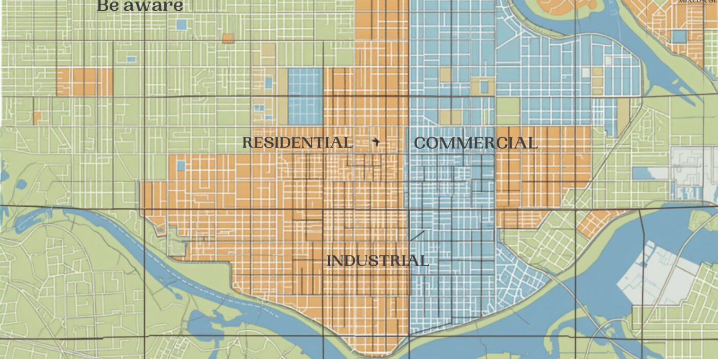
Detailed urban zoning map illustration with color-coded land parcels
CategoriesLand Investment

MRSAC Zoning Maps: Using Maharashtra’s Remote Sensing Data for Land Use Verification

Key Takeaways

  • MRSAC (Maharashtra Remote Sensing Application Centre) is the state’s dedicated agency for satellite remote sensing and GIS data, supporting land-use planning, zoning, and development mapping across departments.
  • MRSAC’s data feeds into various planning tools used by municipal corporations, planning authorities, and departments for Development Plan (DP) and Regional Plan zoning classifications.
  • For a specific plot’s zoning status, buyers typically go through the relevant municipal corporation’s or planning authority’s published Development Plan / zoning maps, which draw on MRSAC and related survey data, rather than querying MRSAC directly for individual plot queries.
  • Confirming a plot’s zoning classification (residential, commercial, industrial, no-development zone, etc.) before purchase is essential — it directly determines what can legally be built or done on the land.
  • Zoning classification is independent of, and should not be confused with, NA (non-agricultural) conversion status — a plot can be NA-converted but still restricted by zoning to a particular use.

Reading time: 7 min | Last updated: July 2026 | By Girish Chhalwani, Founder & CEO, THE EDGE Developments

MRSAC (Maharashtra Remote Sensing Application Centre) is the state agency that generates and maintains satellite and GIS-based spatial data used across Maharashtra’s planning departments, and its data underlies the zoning and Development Plan maps that ultimately determine what a specific plot of land can legally be used for. While individual buyers don’t typically query MRSAC directly, understanding how zoning classification works — and where to check it for a specific plot — is essential due diligence, since zoning restricts land use independently of ownership or NA conversion status.

What Is MRSAC?

MRSAC is Maharashtra’s state remote sensing and GIS agency, providing satellite imagery analysis, land-use mapping, and spatial data support to government departments involved in planning, agriculture, forestry, water resources, and urban development. Its data forms a technical backbone for various planning exercises, including inputs into Development Plans prepared by municipal corporations and Regional Plans prepared by planning authorities.

How Zoning Actually Gets Determined and Checked

For a specific plot, the applicable zoning classification is published through the relevant planning authority’s Development Plan (DP) for urban areas, or Regional Plan for broader regional areas — these are the documents a buyer should reference for a specific plot’s zoning status:

Area Type Where Zoning Is Published
Municipal corporation areas (Mumbai, Pune, etc.) Development Plan (DP) maps published by the respective municipal corporation
Broader regional/peri-urban areas Regional Plan published by the relevant regional planning authority (e.g., MMRDA for MMR)
Special planning areas / notified zones Plans published by the specific special planning authority (e.g., CIDCO, MIDC where applicable)

Common Zoning Categories to Understand

  • Residential Zone — permits housing development, subject to density and FSI norms.
  • Commercial Zone — permits commercial/retail development.
  • Industrial Zone — designated for industrial use, generally restricted from residential development.
  • No-Development Zone (NDZ) — construction is heavily restricted or prohibited, often covering ecologically sensitive, agricultural-preservation, or hazard-prone areas.
  • Reserved Land — earmarked for public purposes (roads, gardens, schools, amenities) under the Development Plan; private construction is typically not permitted regardless of ownership.

Why Zoning Verification Matters — Separate from NA Conversion

A common and costly misunderstanding is treating NA (non-agricultural) conversion and zoning classification as the same thing. They are not: NA conversion changes a land’s revenue classification from agricultural to non-agricultural, while zoning (under the Development Plan or Regional Plan) determines what kind of non-agricultural use is actually permitted on that land. A plot can be NA-converted and still be zoned in a way that restricts it from your intended use — always check both independently.

“I’ve seen buyers assume that because a plot has NA status, they can build whatever they want on it. Zoning is the separate, often overlooked check — a plot can be perfectly NA-converted and still sit inside a reserved or restricted zone under the Development Plan. Always pull the zoning map for the specific plot, not just the NA order.” — Girish Chhalwani, Founder & CEO, THE EDGE Developments

How to Check a Plot’s Zoning Classification

  1. Identify the relevant planning authority for the plot’s location (municipal corporation, regional planning authority, or special planning authority).
  2. Access that authority’s published Development Plan or Regional Plan maps — many are now available as GIS-based online viewers, though availability and detail vary by authority.
  3. Locate the specific plot using its CTS/survey number or address to identify its zoning classification and any applicable reservations.
  4. Where the online map is unclear or the plot appears reserved, confirm directly with the planning authority’s town planning department before proceeding with a purchase.

FAQ

What is MRSAC?

MRSAC (Maharashtra Remote Sensing Application Centre) is the state’s satellite remote sensing and GIS agency, supporting land-use and planning data across government departments.

Can I check my plot’s zoning directly through MRSAC?

Individual plot zoning queries are typically handled through the relevant planning authority’s Development Plan or Regional Plan maps, which draw on MRSAC and related survey data, rather than direct queries to MRSAC itself.

Is zoning the same as NA (non-agricultural) conversion?

No — NA conversion changes a land’s revenue classification, while zoning (under the Development Plan) determines what specific use is permitted on that land. Both should be checked independently.

What is a No-Development Zone (NDZ)?

It’s a zoning category where construction is heavily restricted or prohibited, often applied to ecologically sensitive, agricultural-preservation, or hazard-prone areas.

Can reserved land under a Development Plan be privately built on?

Generally no — land reserved for public purposes like roads, gardens, or amenities is typically restricted from private construction regardless of ownership.

Where do I find the Development Plan for a specific area?

Through the relevant municipal corporation’s or regional planning authority’s official published Development Plan or Regional Plan maps.

Why should I check zoning before buying land, even if it’s already NA-converted?

Because NA conversion alone doesn’t guarantee your intended use is permitted — zoning classification independently restricts what type of development is allowed on the land.

Citations & Sources

  • Maharashtra Remote Sensing Application Centre (MRSAC)
  • Maharashtra Regional and Town Planning Act, 1966

Related Reading

Confirm Zoning Before You Commit — Not After

THE EDGE Developments checks zoning classification, NA status, and reservation details on every plot we recommend, so there are no surprises after purchase.

connect@theedgedevelopments.com | Phone: +91-9664662938

Old Mumbai chawl buildings beside new high-rise towers
CategoriesLand Investment

SRA Redevelopment Records: Checking Slum Rehabilitation Authority Documentation in Mumbai

Key Takeaways

  • The Slum Rehabilitation Authority (SRA) oversees redevelopment of slum land in Mumbai into formal housing, and units allotted under this scheme carry distinct documentation and resale rules.
  • SRA-allotted flats typically carry a lock-in / transfer restriction period (commonly around 10 years from allotment, subject to specific scheme terms) before free resale is permitted.
  • Buyers of SRA-redeveloped units should verify the eligibility certificate, allotment letter, and any transfer permission/NOC from the SRA before purchase, in addition to standard title checks.
  • Not all units in an SRA-redeveloped building are equal — some are allotted to original slum-dwellers (PAP – Project Affected Persons) with restrictions, while others may be “sale component” units developed for open market sale with fewer restrictions.
  • Buying an SRA unit without confirming its specific category and transfer status can lead to serious complications, including a sale being challenged or blocked.

Reading time: 7 min | Last updated: July 2026 | By Girish Chhalwani, Founder & CEO, THE EDGE Developments

Properties in SRA (Slum Rehabilitation Authority) redeveloped buildings in Mumbai carry a documentation and resale framework distinct from standard flats, and buyers need to understand exactly which category of unit they’re purchasing before proceeding. SRA schemes typically produce two broad categories of units within the same redeveloped building — rehabilitation units allotted to original eligible slum-dwellers, and “sale component” units built for open-market sale to fund the redevelopment — and the rules governing resale differ significantly between them.

What Is the SRA and How Redevelopment Works

The Slum Rehabilitation Authority is a Maharashtra government body that facilitates redevelopment of slum land into formal, multi-storey housing. Under the typical model, a developer redevelops the land, provides free rehabilitation flats to eligible original slum-dwellers (verified as Project Affected Persons, or PAP), and is permitted to construct and sell additional units on the open market (“sale component”) to make the project financially viable.

Key Documents to Check for SRA Properties

Document Purpose
Eligibility/Allotment Certificate Confirms whether the unit is a PAP rehabilitation flat or a sale-component unit
Transfer NOC from SRA Required for resale of rehabilitation units, especially within the lock-in period
Occupancy Certificate Confirms the building has received formal completion/occupancy approval
Society Registration & Share Certificate Confirms formal cooperative housing society status and the seller’s membership

PAP Rehabilitation Units vs Sale Component Units

  • PAP Rehabilitation units are allotted free to eligible original slum-dwellers and typically carry resale restrictions for a lock-in period (commonly cited around 10 years, though exact terms depend on the specific scheme and should be confirmed with SRA directly), along with a requirement to obtain SRA transfer permission even after the lock-in.
  • Sale component units are constructed for open-market sale and generally carry fewer SRA-specific restrictions, functioning closer to a standard flat purchase, though buyers should still confirm the building’s overall compliance status.

“The mistake I see most often with SRA properties is buyers not realizing which category of unit they’re actually looking at. A rehabilitation flat still inside its lock-in period being sold without proper SRA transfer permission is a transaction that can unravel later. Get the eligibility certificate and transfer NOC checked before you’re emotionally invested in the deal.” — Girish Chhalwani, Founder & CEO, THE EDGE Developments

How to Verify SRA Documentation Before Buying

  1. Request the specific unit’s eligibility/allotment certificate from the seller to confirm whether it’s a PAP or sale-component unit.
  2. If it’s a PAP rehabilitation unit, confirm the lock-in period status and whether a valid SRA transfer NOC has been obtained.
  3. Verify the building’s Occupancy Certificate and the cooperative society’s formal registration.
  4. Where uncertain, a direct written query to the SRA office referencing the specific scheme and building can confirm current transfer eligibility.
  5. Engage a lawyer experienced specifically in SRA transactions, since the documentation and risk profile differs meaningfully from standard resale flats.

FAQ

What is the SRA?

The Slum Rehabilitation Authority is a Maharashtra government body overseeing the redevelopment of slum land into formal housing in Mumbai.

What’s the difference between a PAP unit and a sale component unit?

PAP (Project Affected Person) units are allotted free to eligible original slum-dwellers with resale restrictions; sale component units are built for open-market sale with generally fewer SRA-specific restrictions.

Is there a lock-in period on SRA rehabilitation flats?

Yes, rehabilitation units typically carry a resale lock-in period, commonly cited around 10 years, though exact terms depend on the specific scheme and should be confirmed directly with the SRA.

Do I need SRA permission to buy a rehabilitation unit?

Often yes — a transfer NOC from the SRA is typically required for resale of rehabilitation units, particularly within the lock-in period.

Are sale component units easier to buy than rehabilitation units?

Generally yes, as they carry fewer SRA-specific transfer restrictions, functioning closer to a standard flat purchase, though building-level compliance should still be verified.

How do I check if an SRA unit’s transfer is legally valid?

Request the eligibility certificate and transfer NOC from the seller, and where uncertain, verify directly with the SRA office referencing the specific scheme and building.

Should I use a specialized lawyer for SRA property purchases?

Yes, SRA transactions carry a distinct documentation and risk profile compared to standard resale flats, making specialized legal review advisable.

Citations & Sources

  • Slum Rehabilitation Authority, Government of Maharashtra

Related Reading

Considering an SRA Property? Know Exactly What You’re Buying

THE EDGE Developments verifies SRA eligibility status, transfer permissions, and building compliance before you commit to a purchase.

connect@theedgedevelopments.com | Phone: +91-9664662938